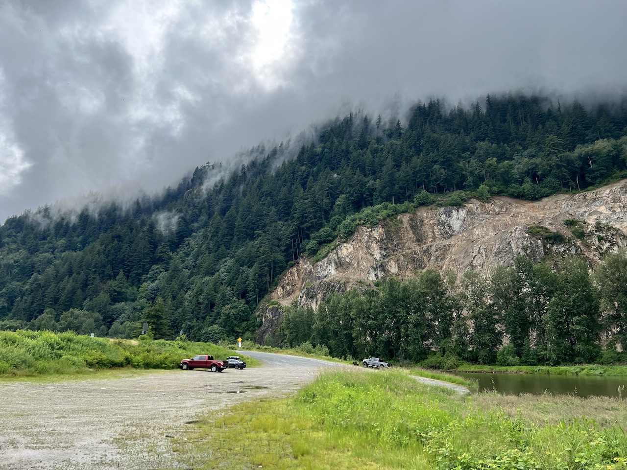
- Parking:
- Launching
- Sandy river bank off the boat launch ramp
- Difficulty – Sumas River is very calm and slow. Vedder River has a noticeable but surmountable current. Fraser River was brisk and not to be trifled with. Main hazard is boat wake, making this a padddle with intermediate-level difficulty.
- Boat traffic – many motor boats encountered on our 2.5 hour paddle, most of them going at full speed kicking up sizable wakes.
- View – nice, serene river views which slowly expand as you paddle downstream towards Fraser River. At highest of water levels (think spring runoff in a high-water year), the Sumas River rises high enough to flood a side channel and the nearby woods, creating a unique ‘floating forest’ where you can paddle among trees.
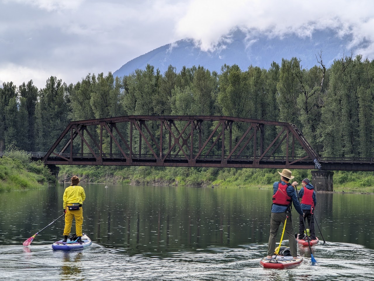
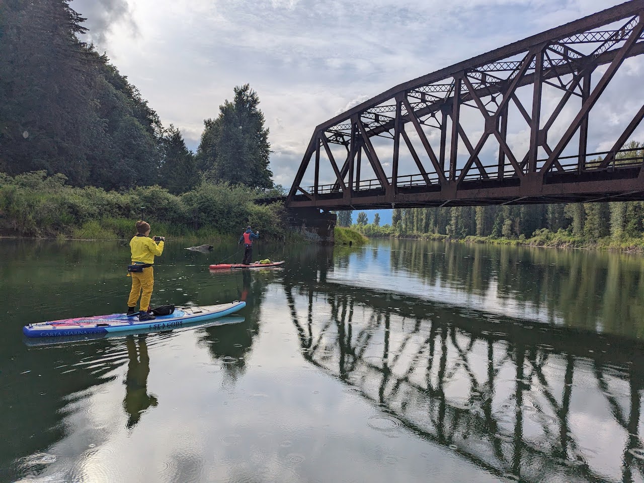
- Other paddle highlights – paddling under a cool metal railway bridge. The merging of clear blue water from Vedder River and the cloudy brown water of Sumas River. And: So. Many. Beavers.
- Facilities – none. No toilet facilities.
- Overall score – 8/10
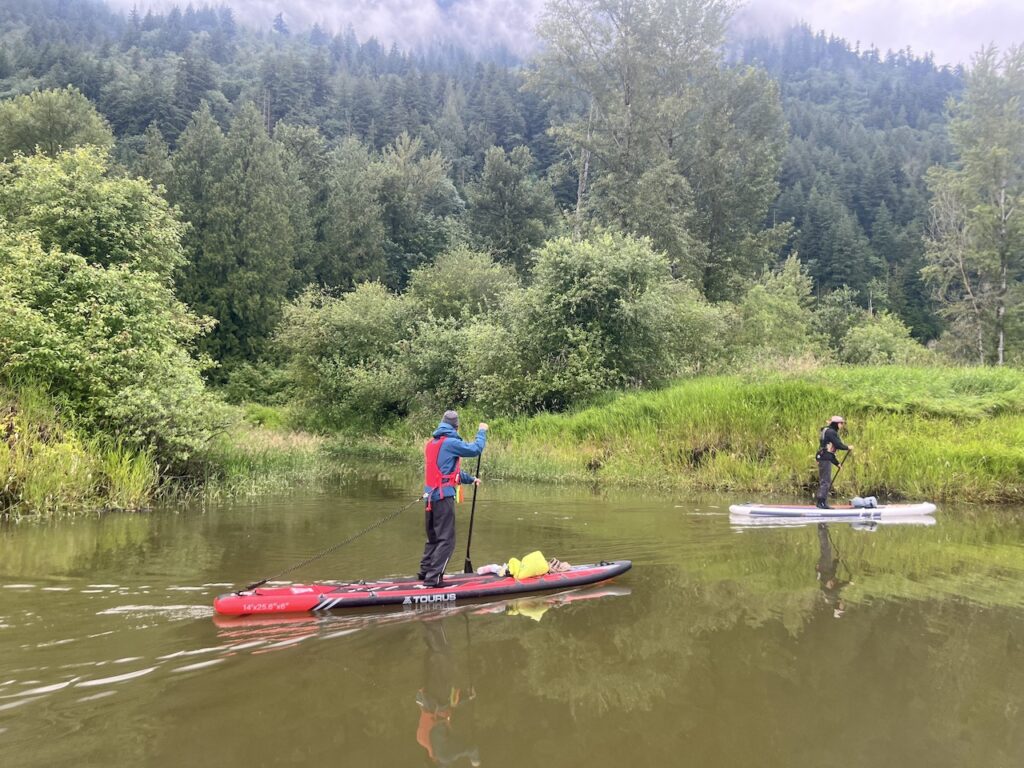
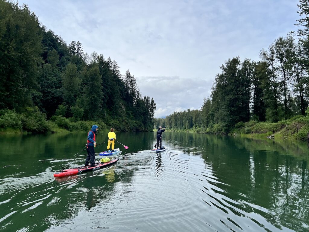
The fabled ‘Floating Forest’ has been mentioned numerous times in local paddling communities, but it’s never clear to me exactly where it is or how to get there. So when Howard called for a Sumas River Floating Forest paddle, I jumped on the chance. I had a great time paddling with Howard on Harrison River, and this was our second outing together. We were joined by Nick and Amanda, two other active members of our Facebook SUP group.
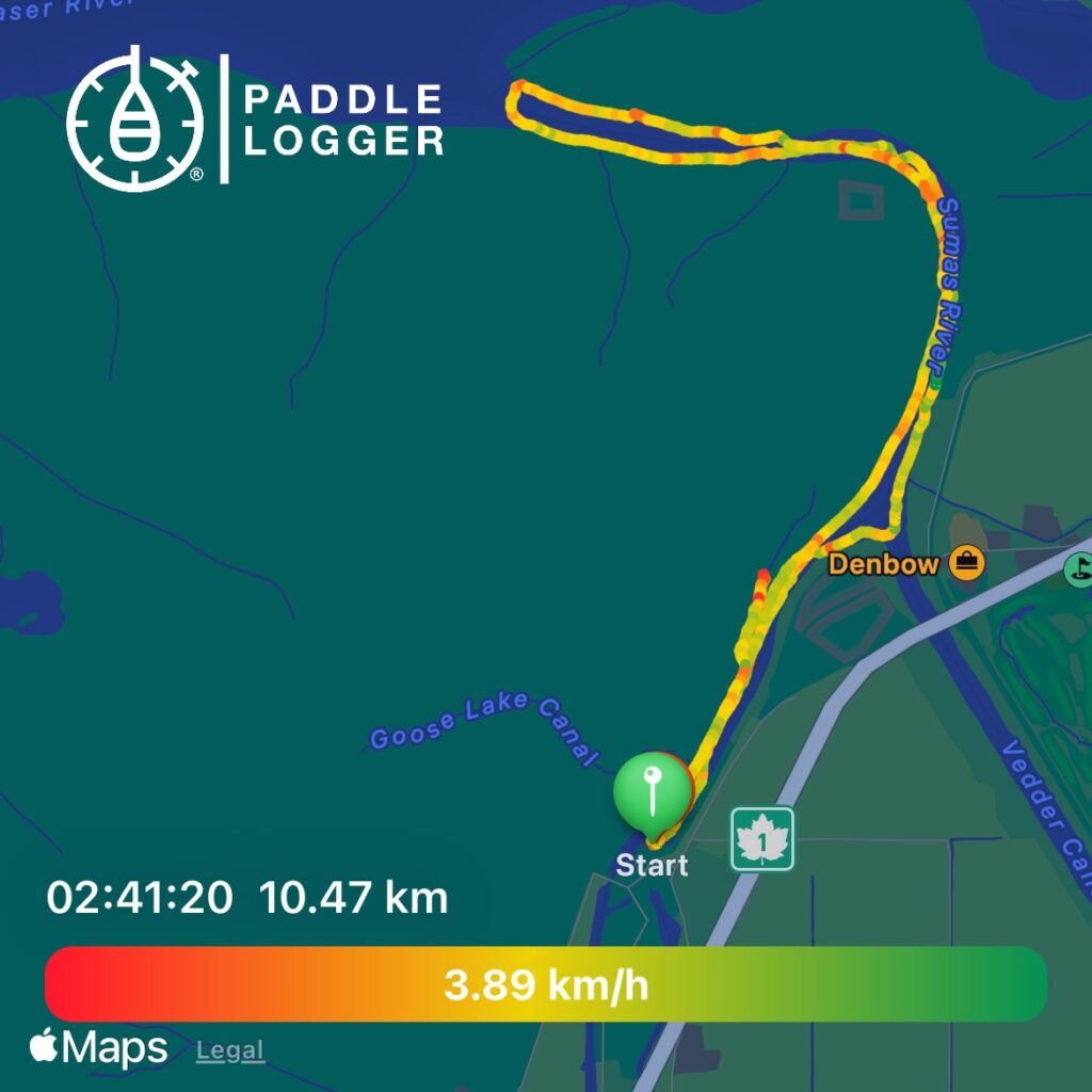
The launch is a no-frills gravel boat launch. There was ample parking on this Sunday evening.
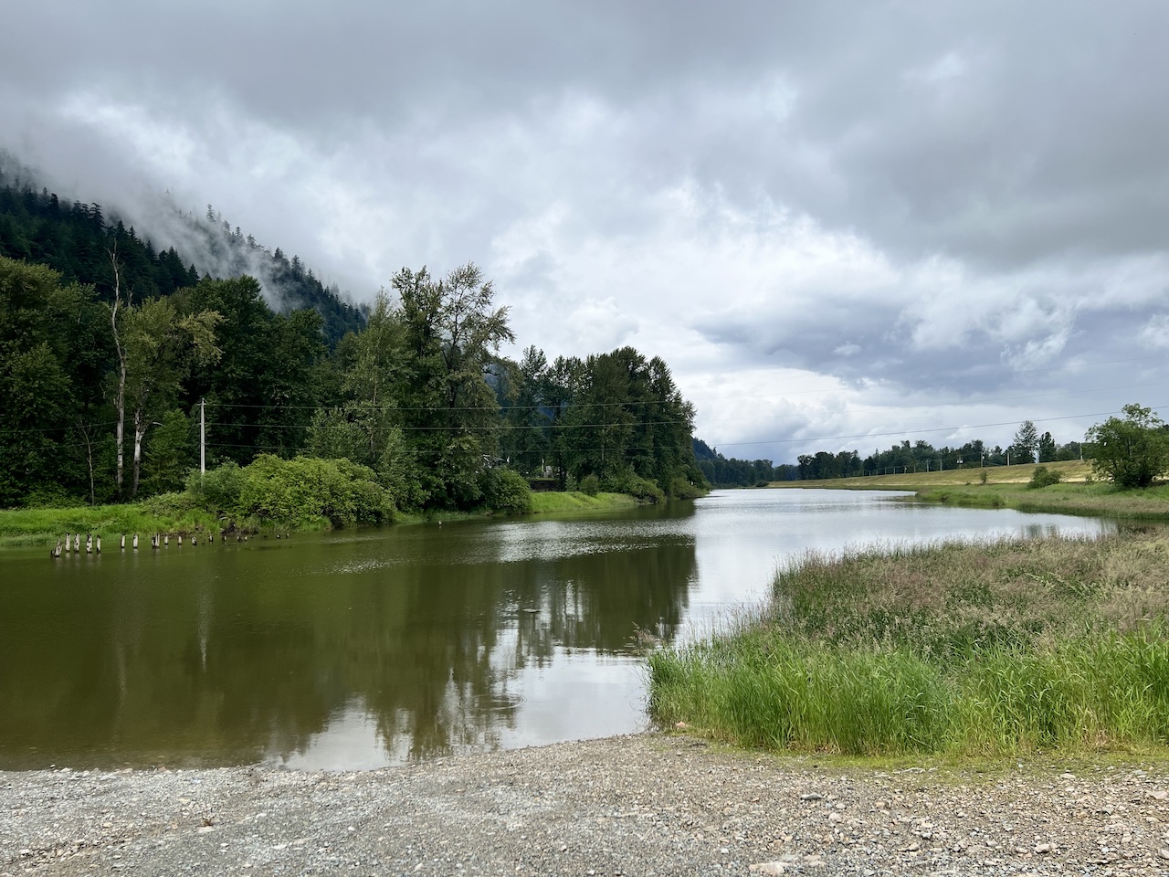
The water in Sumas River is the typical muddy, silty type you find on the lower sections of Fraser River.
But about 1.5km into the paddle, we came upon the merge point with the glacier-fed Vedder River, with its clear blue water. Howard pointed out how much colder the water is here. (Google Maps labels this as Chilliwack River, but the same river has two names; upstream from Vedder Crossing is Chilliwack River, and downstream is Vedder River. More specifically, this section of Vedder is the Vedder Canal, which is a perfectly straight, man-made canal to divert Vedder River into the Sumas River, in order to drain the Sumas Lake and form the Sumas Prairie)
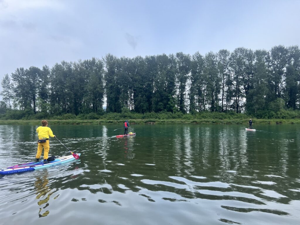
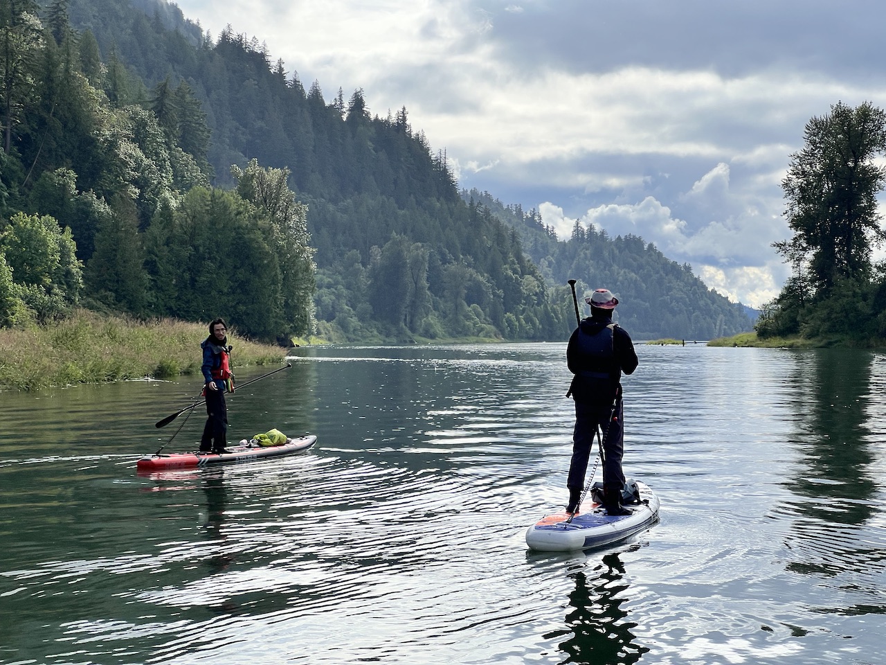
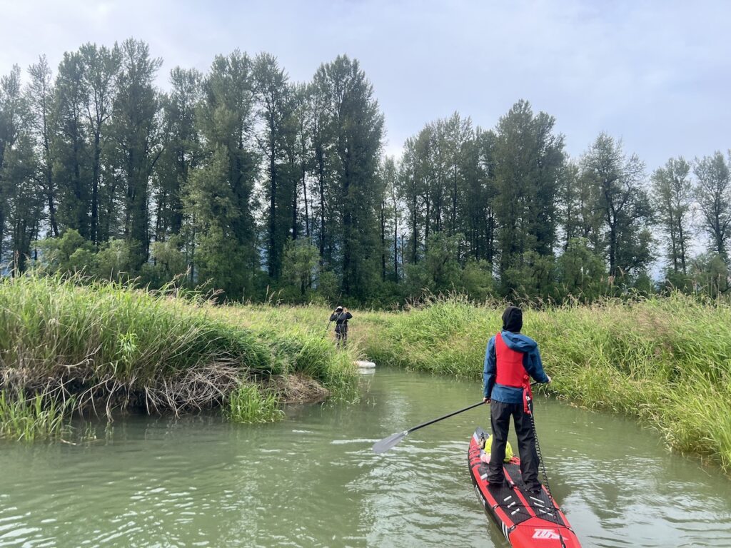
We continued downstream, enjoying a 95% tranquil, serene paddle without traffic noise, punctuated with 5% of fishing boats ripping through the silence at high speeds. The river wasn’t too wide, and the twists and turns obstruct the boaters’ view, so it was important to stay close as a group and off to one side.
As we approached Fraser River, a metal railway bridge came into view, providing an interesting juxtaposition of industry and nature.
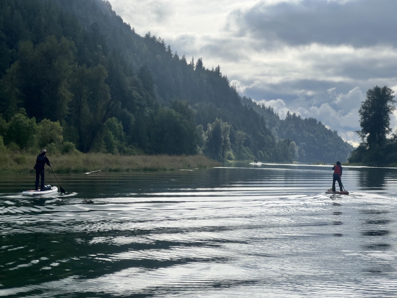
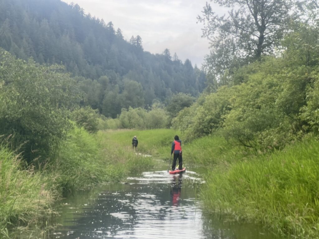
After the bridge, the river became wider and the views became more expansive. It was quite the experience paddling through moody clouds, a brief shower, and peek-a-boo sunshine. On a few occasions when all four of us stopped paddling, the whole world seemed quiet, save for some occasional birdsong.
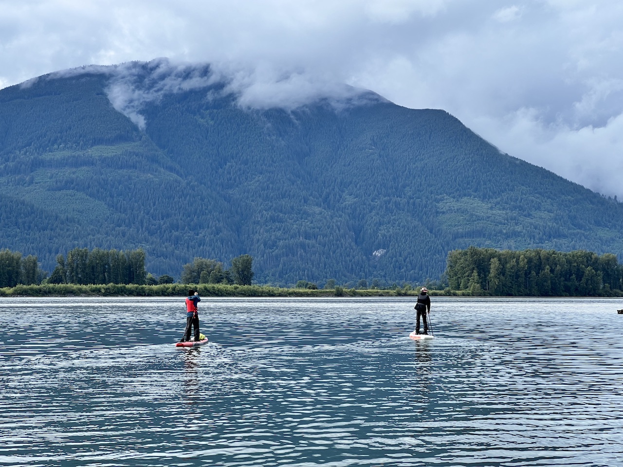
We poked our heads out to look at the mighty Fraser River, which was floating strongly. Likely too strong to paddle against, so we cautioned each other not to get too close. Not wanting to accidentally paddle and additional 70km back to Vancouver, we turned around.
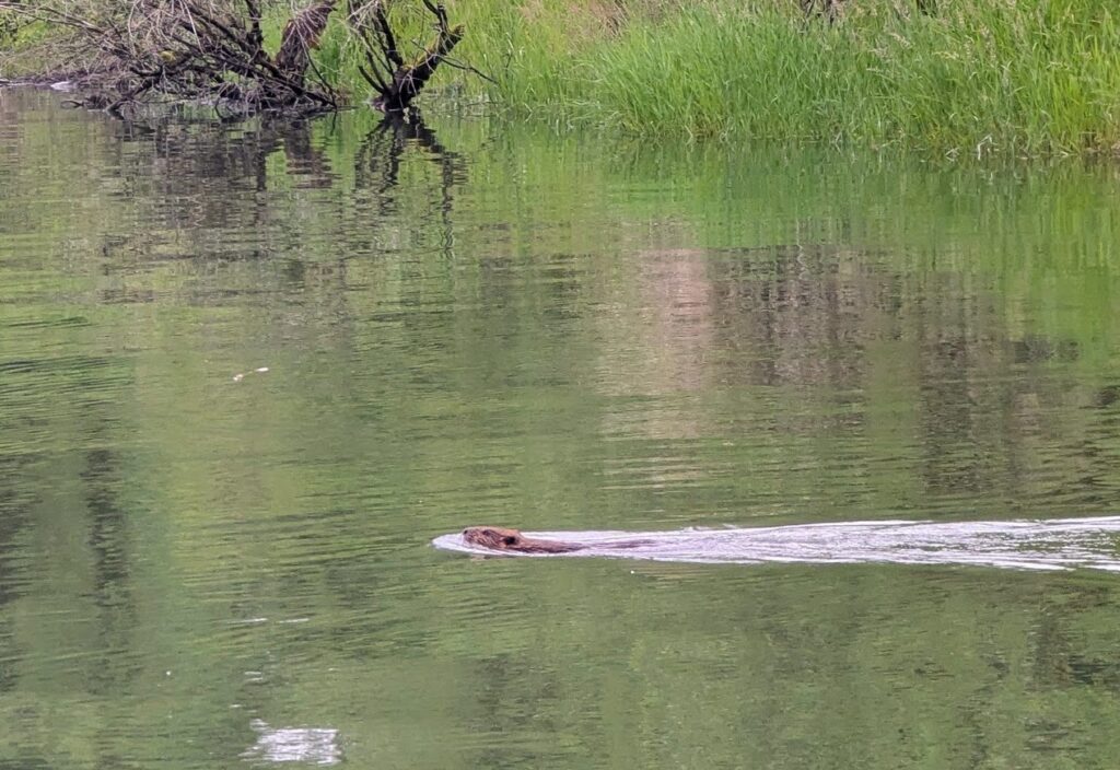
On the return leg, we ran into not one, not two, but 7-8 beavers in total. Of all the paddling adventures we each had, none of us have ever seen this many beavers on one paddle!
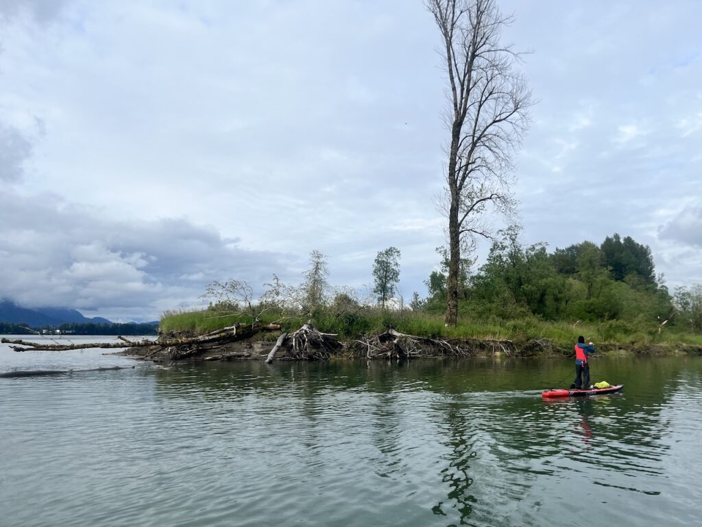
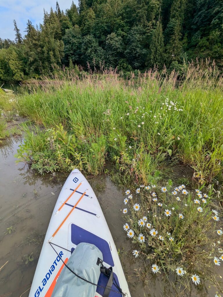
Finally, we ended our paddle with an attempt at the Floating Forest. The side branch of Sumas that leads to the Floating Forest is visible on Google Maps satellite view, and quite easy to find. It’s about half way between the boat launch and the confluence with Vedder River, on the river left.
Very quickly, the channel narrowed and we became bogged down by overgrown weeds. The forest were also many feet higher than us, so there was no way the water was high enough to ‘float the forest’. We were happy with the effort and turned around. It was tricky to turn 3 touring and 1 racing board around.
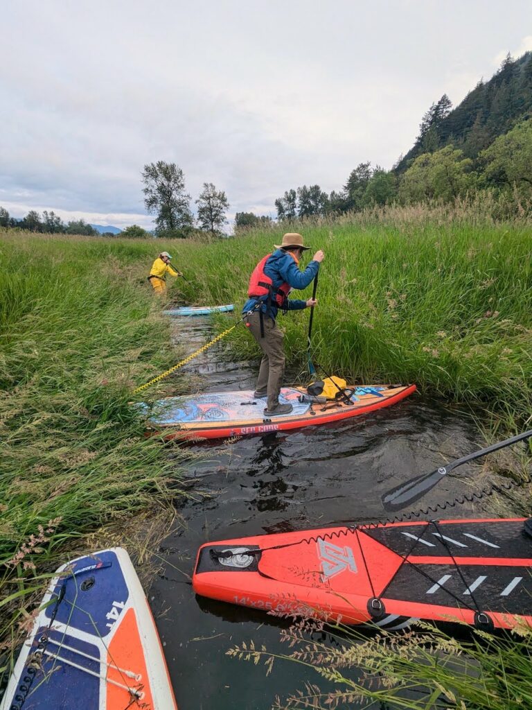
So there it was! A nice, leisurely 10km paddle on Sumas River, with a valiant attempt at seeing the Floating Forest but the water was probably 10 feet too low.
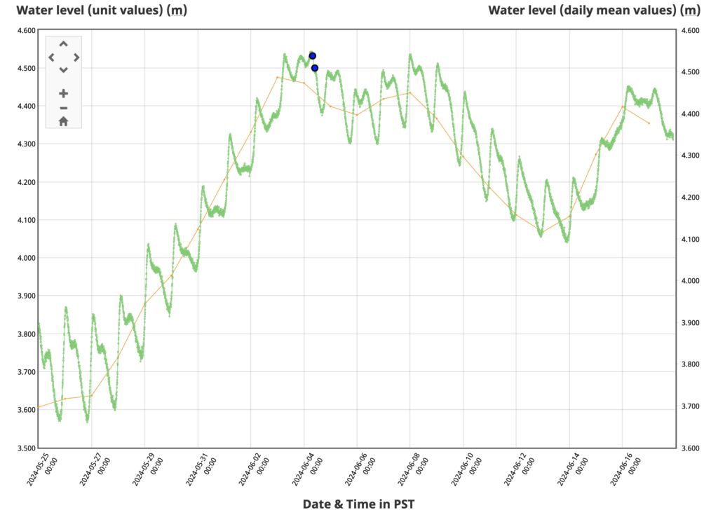
Per Environment Canada, the water level in Fraser River at Cannor Station (closest to Sumas River) is usually at its highest point in June, reaching about 6 to 7.5m. Today, it’s at a measly 4.5m. If you are serious about seeing the Floating Forest, you should check the water level at this station and come out if the level is higher than 6.5m. The water here is tidal, but the effect is not very significant, only about 20cm of intra-day variation per the water station measurements.
2 responses to “Sumas River Paddle (and an attempt at the Floating Forest)”
Hi, I Hve couple questions.
1. Would you mind sharing which website you used to look up on the water level for the floating forest? I tried Looking up online and can’t find any. Thank you.
2. For the river of golden dreams, did you use inflatable or solid SUP? I have an inflatable one? Not sure if it will be save as I heard about the risks of puncturing. This would be my first attempt with my husband (who also never done this and doesn’t swim). It’s too late to join a tour. Also curious to know when will you go again and hoping to join as well. Thank you.
3. What other paddle board areas would you recommend for me to build skills in order to attempt river of golden dreams. I have done 2 years paddle board more in the calm river, like Hayward lake. Find my self struggle to paddle board against wind in e.g., deep cove and buntzen lake (when the wind was really strong that you see waves on the water).
Thanks for your time and help.
1. I think this is the closest water station: https://wateroffice.ec.gc.ca/report/real_time_e.html?stn=08MF038
2. I used inflatable SUPs for River of Golden Dreams: https://www.outdoorfam.ca/2021/07/16/river-of-golden-dreams/ but with all river paddles, there is definitely a risk of puncturing, getting caught in debris, etc. I strongly recommend that both you and your husband get comfortable with the paddleboards including confidence in turning and self rescue before attempting this river. You should also look into proper river gears like short river fins and quick release leash. I don’t have plans to go back to do the River of Golden Dreams any time soon. I suggest joining a few local SUP Facebook groups and go with experienced paddlers.
3. Check out my post on paddling locations ranked by difficulty and sorted by river vs. open water: https://www.outdoorfam.ca/list-of-paddleboarding-destinations-ranked-by-skill-level/, and again, paddle a few times with experienced paddlers. They can usually give you a few pointers. Better yet, taking a few lessons from licensed instructors will really boost your skill level.
Have fun and stay safe on the water!