Quick Facts
- Parking and Launching:
- Launching type:
- Ferry Road: dock and boat ramp
- Ladner Wharf: dock
- Wellington Point: boat ramp
- Difficulty – intermediate due to boat wakes and river current
- Boat traffic – many motor boats especially on a weekend afternoon
- View – muddy Fraser River slough and marshes, distant views of North Shore mountains
- Facilities:
- Ferry Road: flush toilet
- Ladner Wharf: a portable toilet
- Wellington Point: few picnic tables and a portable toilet
- Overall score – 7/10
I originally grouped this post with Deas Slough Paddle, but the two sections of Fraser River, although connected, are quite distinct. Unlike the blind channel in Deas Slough, the water flow in this side branch of Fraser South Arm is heavily affected by tidal current, which is strong enough to reverse the river flow during a flood (rising) tide. Be sure to check the tide table, wind speed and direction to plan your route and consider backup plans (eg. if you wanted to do an out-and-back paddle, be prepared that it may be too difficult to do so).
There are several great launching and pull out points to choose from to explore the Ladner Marsh, all featuring free parking and public washrooms.
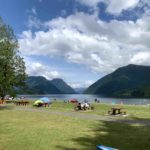
Approximate locations of the launch points described below.
- Ferry Road Boat Launch is a concrete boat ramp located at the mouth of Deas Slough. It has a small parking lot and a nice public washroom. You can go right (east) to explore Deas Slough, or left (west) to check out Ladner Marsh.


- Wellington Point Park is a small park with a concrete boat ramp before Westham Island. There are no public launching/pull out spots further downstream that I’m aware of, so I didn’t venture past this point.


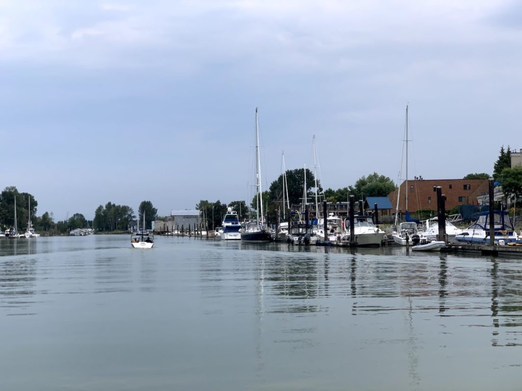
- Ladner Wharf is a small public dock next to Sharkey’s Bar and Grill, where motorboats can be moored for up to 3 hours


Paddle Report May 22, 2021: Ladner Marsh
I wanted to paddle on a Saturday afternoon, but Deas Slough was scheduled for water skiers. So I went to the Ferry Road Boat Launch and headed downstream to explore Ladner Marsh.

There was a 5km/h headwind and the tide was still coming in (I launched about 1 hour before high tide).


I paddled past some nice floating homes at Ladner Harbour and a resident swan. Many of the occupants were out on their decks enjoying the sun, and were all very friendly as I paddled by.


On a warm, sunny Saturday afternoon, I wouldn’t call this paddle calm or quiet, as there were many motor boats speeding up and down the river. The wakes they make can be sudden and powerful, likely enough to knock over a beginner paddleboarder. As an intermediate paddler, I had to slow down, position myself correctly, and brace with my paddle.

Going straight from Deas Island to Wellington Point is about 7.5km, which should take about 1.5hours. The usual point-to-point paddle logistical challenge applies. If the tide and wind conditions allow, I believe this is doable as an out-and-back paddle for about 3 to 3.5 hours. If you wish to explore the marshes and islands more thoroughly, such as circumnavigating Gunn Island, you could easily add another couple of hours here without getting bored.
I would avoid the temptation of crossing the main trunk of the South Arm of Fraser River and hop on over to Richmond though, as the water currents can be strong and unpredictable, and it’s heavily used by commercial boats.
Paddle Report July 31, 2021: Going Deeper into the Ladner Marshes

I came back again when I had a couple hours to paddle. Even on the Saturday afternoon of the August Long Weekend, there was barely any traffic here. No trouble parking at Ferry Road boat launch and I didn’t even see another paddler on the river.
I explored a side channel on my way down south.


The water gets pretty still and murky as soon as you turn off the flowing branches of Fraser River. Thankfully nothing smelled foul, as this is a protected South Arm Marshes Wildlife Management Area (ie. no manure).

I turned left and went deeper into Ladner Harbour this time.

Near the end of Ladner Harbour sits the Ladner Wharf, a public dock near a sizeable public parking lot and Sharkey’s Bar and Grill, a low key waterfront restaurant.
I kept paddling, deciding to see where the water leads. I went under the bridge for Mcneelys Way and kept being surprised by how easy it was to continue.

The exploration kicked up a notch, as I had no idea what to expect. The water became a narrow ditch with muddy and murky water along Ferry Road, but surprisingly deep. I could hear cars and trucks going by but I couldn’t see them through the dense vegetation.

At one point I thought I might be able to get all the way back to the launching spot at Ferry Road, which got me excited about discovering an interesting and undocumented paddle loop.
But alas, I finally hit some fallen tree branches and didn’t want to bother wading in the muddy water to portage across it. So I turned back and headed back into Ladner and ended my paddle at Wellington Point Park again.

This was a paddle about 2 hours after full tide, so the water was still quite high. Definitely would not have gone nearly as far if I came here at low tide. It was fun to play in the ditches and follow where the water took me, but I definitely paid extra attention rinsing off my board that day.
Discover more from Outdoor Family
Subscribe to get the latest posts sent to your email.
Pingback: Deas Slough Paddle – Outdoor Family