Quick Facts
- Parking and Launching: Deas Island Regional Park (49°07’34.5″N 123°03’18.2″W)
- Launching type: dock and muddy beach
- Difficulty – easy, but with occasional boat wakes
- Boat traffic – usually infrequent
- View – muddy Fraser River slough and marshes, distant views of North Shore mountains
- Facilities: picnic tables, a regional park with trails, toilet about 100m away
- Overall score – 7/10
Deas Slough is a well-sheltered blind channel in the lower Fraser River. Because it’s sealed off from Fraser South Arm, the water here is rather stagnant, with no discernible river current.
Being so well protected from the river and wind, Deas Slough can be very calm if there weren’t motorboats around. The water was so still here that on one visit in the winter, the slough was actually frozen over and thwarted my paddle plan. Best bet to avoid motorboats would be early in the morning when all the recreational boaters seem to be sleeping.

Besides the weather, wind, and tides, be sure to check the Deas Slough Use Schedule to see if the time slot is open to paddle sports. Since this area is popular for water skiers, Management came up with this schedule in an attempt to reduce conflicts on the water.
Based on my personal experience though, the rules don’t seem to apply to powerboats without water skiers, as I’ve seen boats kicking up wakes up and down the slough during time slots designated for paddle sports. In fact, since I was still fairly new to paddleboarding when I first visited here, I was actually knocked off my board by a passing boat.

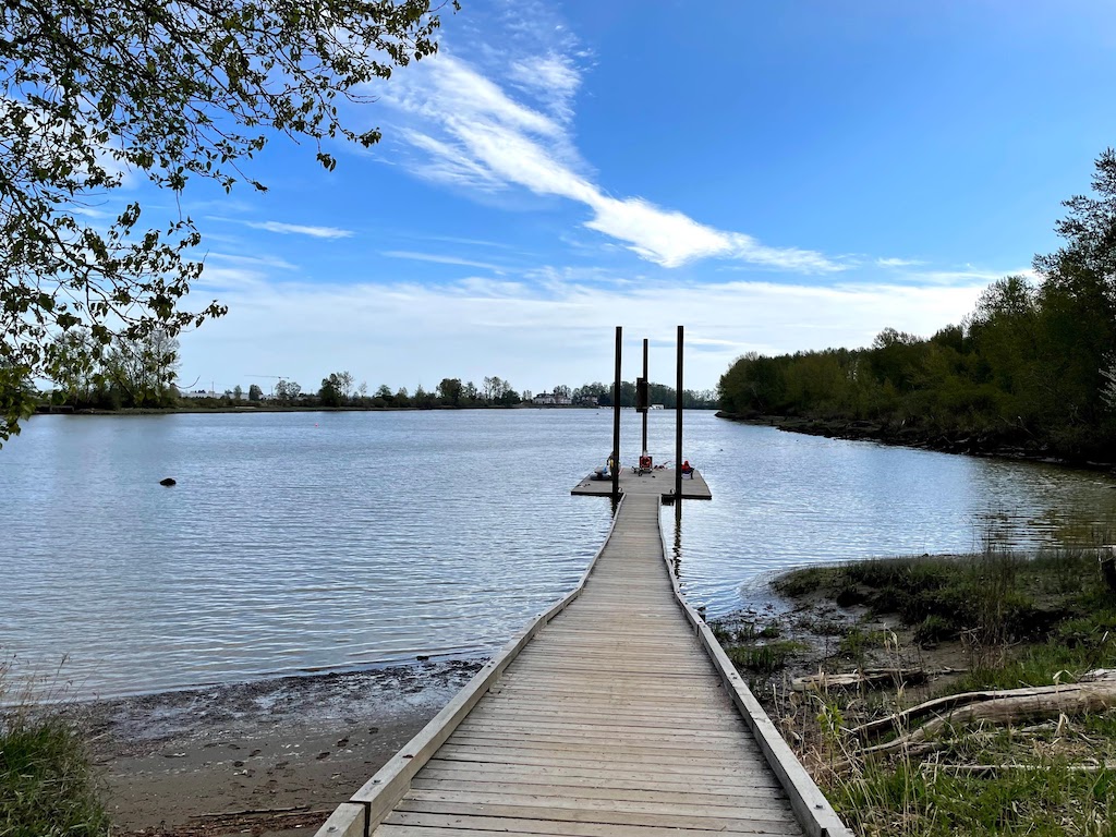
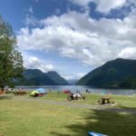
The public dock in Deas Island Regional Park (49°07’34.5″N 123°03’18.2″W) is very close to a large gravel parking lot which is almost never full even on a sunny weekend. This is the inner most launch point of Deas Slough and a great launching location to explore the slough and Ladner Marches downstream. The rest of Deas Island Regional Park is worth exploring as well.


An alternate launching and pullout location to explore Deas Slough is Ferry Road Boat Launch, a concrete boat ramp located at the mouth of Deas Slough just before it merges with Fraser South Arm. There is a small parking lot and a nice public washroom.


I originally wrote this post to include more launch spots further downstream around Ladner Marshes, but I decided to break that off into a separate post.

The water here is very muddy. I wouldn’t recommend swimming anywhere in the Lower Fraser River, which includes Deas Slough. Brand new paddlers who may still be prone to falling in should take this into account.
Another word of caution for beginners is that there aren’t any easy landing spots in the slough besides the docks at either end. In an emergency, you could try to get onto the muddy banks, but it would take considerable effort to navigate the thick, soft mud piles with overgrown grass.

Paddle Report
After putting the kids down for a nap, I had a few hours to spare on a Sunday afternoon, so I headed to Deas Slough for a quick exercise lap. When I first visited in 2020, I was too new to paddleboarding to comfortably take photos, but now, 2 years later, I was much more surefooted.
I launched from the Deas Island dock and paddled south. The view on the outbound journey was not very exciting, but there were some opportunities for bird watching.

Soon I approached the busy Highway 99, which goes over a short bridge before it plunges into the Massey Tunnel. Since my SUP obsession started, every time I drive pass this bridge I couldn’t help but sneak a peak at the calm Deas Slough and daydream.


After the bridge, I paddle past Captain’s Cove Marina with lots of sailboats. Not too much further, I arrived at the tip of Deas Island and the end of Deas Slough.

I rounded the corner and admired the visibly faster water current in Fraser South Arm. I could totally see how someone might get into trouble if they ventured onto Fraser River unprepared. The North Shore mountains revealed themselves as I poked my head around the corner, but I didn’t linger.

Heading back, the best view of this paddle presented itself after re-crossing under the Highway 99 bridge. The images were deceivingly tranquil, but the truth was, the traffic was continuously roaring just behind me.


At only 5.3km, the paddle was shorter than I remembered. But it was a perfect length this day, because by the time I got home, the boys just woke up from their nap.

Discover more from Outdoor Family
Subscribe to get the latest posts sent to your email.
Pingback: Deas Island Regional Park – Outdoor Family
Great thorough report, very helpful. Thanks!
Next time, hit me up, I would have paddled with you!
Thanks for the comment, Sherm! It’s been too long since our last paddle outing for sure. Next time!
Pingback: Brunswick Point Trail – Outdoor Family
Pingback: Ladner Marsh and Harbour Paddle – Outdoor Family
Pingback: Top 11 Destinations For Beginner Paddleboarders in Metro Vancouver – Outdoor Family
Pingback: Paddling Alouette River – Outdoor Family
Pingback: Paddling around Shady Island in Steveston Channel - Outdoor Family
Pingback: Paddling around Shady Island near Steveston, Richmond - Outdoor Family