
After a 2-year hiatus from paddle camping since our unforgettable trips to Granite Falls and Sechelt Inlet, the stars aligned for Johnny and I to team up once again for another quick but impactful overnight paddling trip at Moyer Creek Marine Campsite on Alouette Lake.
We had 2 days to plan, and we quickly narrowed down our options to Bowen Island, Pitt Lake, Twin Island, and Alouette Lake in Golden Ears Provincial Park. These are the most accessible choices in the Lower Mainland. Howe Sound Marine Trail and Harrison Lake would both be epic but still out of our league.
We’ve done Indian Arms already and Twin Island seemed much too short of an adventure. Pitt Lake is a bit daunting, and Bowen Island required a ferry ride or an open ocean crossing, so we settled on Alouette Lake.
Designated marine campsites on Alouette Lake are:
- East Beach, which is waaay too short for a marine camping experience at only 500m from the busy day-use South Beach, but this may actually be an interesting option for practicing paddle camping for the first time
- Moyer Creek, 9.5km from South Beach
- The Narrows, 10.5km
- Alouette River, 16km
We chose Moyer Creek for it hits the sweet spot of enough interesting paddling without posing too much of a challenge.
The weather forecast called for light rain, with winds of around 6-10km/h. As long as there’s no thunder and lightening, paddling in a light rain is actually quite enjoyable.
Packing for this trip was remarkably easy even after a 2-year break from paddle camping. The main difference from front country car camping is lighter cooking apparatus (Johnny brought his backpacking MSR stove), food rations (dehydrated pouches), and food storage (I packed my bear canister as there is no bear cache or food hang here). I brought two dry bags, one larger 55L one for things that really need to stay dry: sleeping bag, dry clothes, electronics, which were packed in smaller dry bags, and a smaller 30L one for easy access on the paddle (snacks, jacket). I also brought a duffel bag to store my tent, camping chairs, ropes, and other things that can get wet without affecting their function.
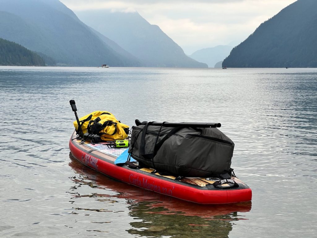
Golden Ears Provincial Park requires a day-pass during the summer, but a backcountry permit ($5/person/night) can also be used to gain access. Overnight parking on the South Beach parking lot is permitted for people camping at the marine sites, and we registered our license plate number when we bought the permits.
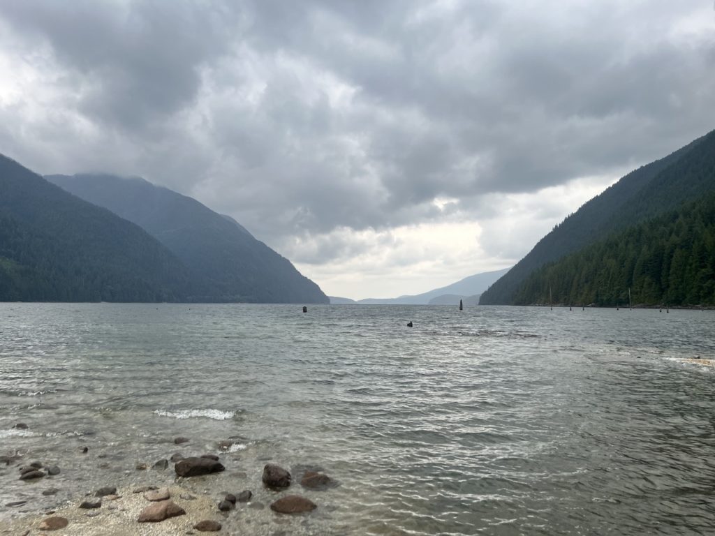
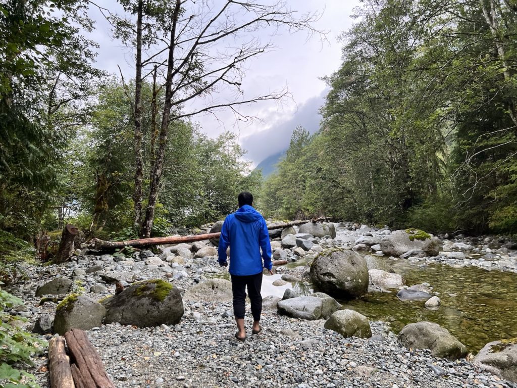
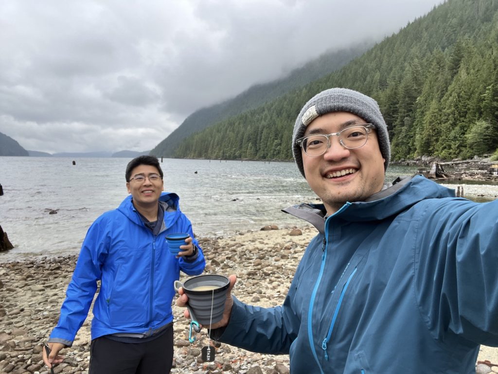
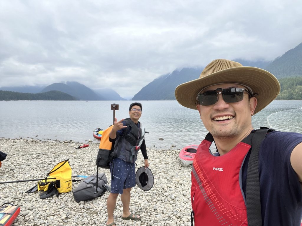
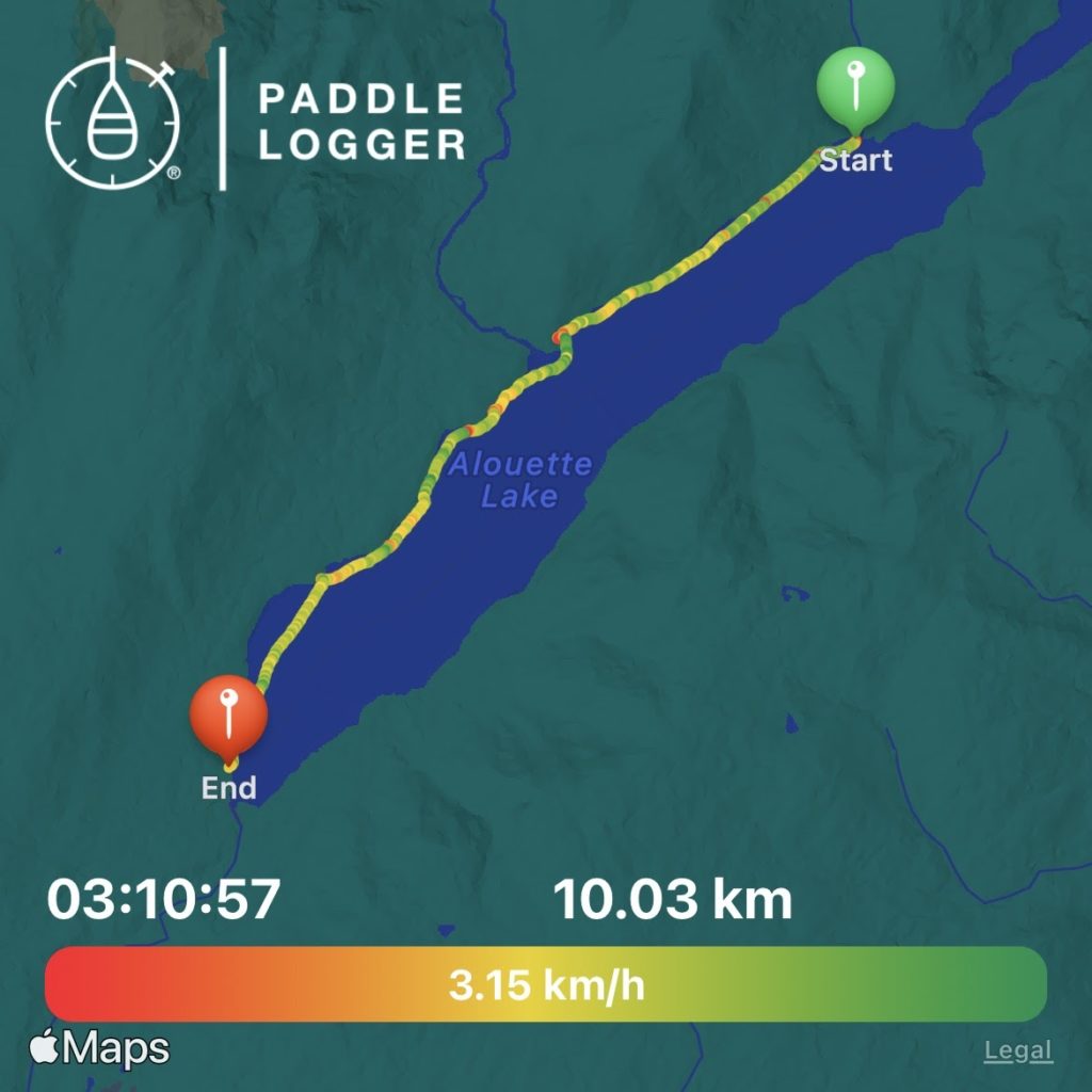
With everything loaded, we launched at 1pm under a cloudy sky.
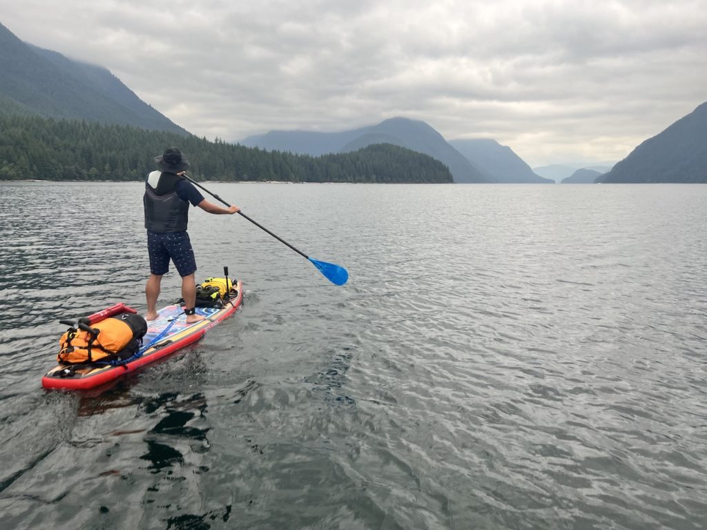
The southerly winds gently pushed us along, and in 30 mins we reached Campers Beach.
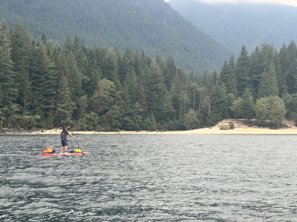
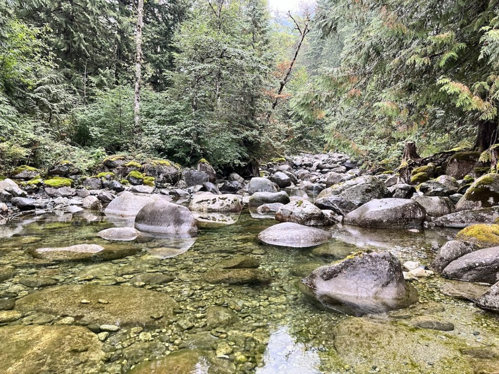
North Beach quickly followed. We rounded the corner and passed some campers fishing at the mouth of Gold Creek, and went upstream to explore.
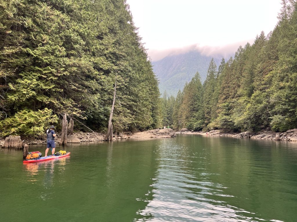
The lower sections of Gold Creek is remarkably calm with barely any perceptible current. The water was crystal clear and refreshing. After about 350m, we hit the end of paddle-able waters.
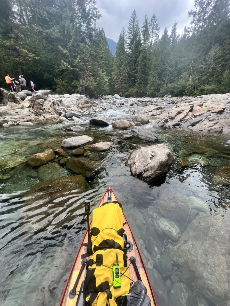
We stopped for a quick snack on our boards next to the rushing waters, then headed back out onto Alouette Lake.

By then, the winds and waves started to pick up. The clouds thickened and threatened to rain.
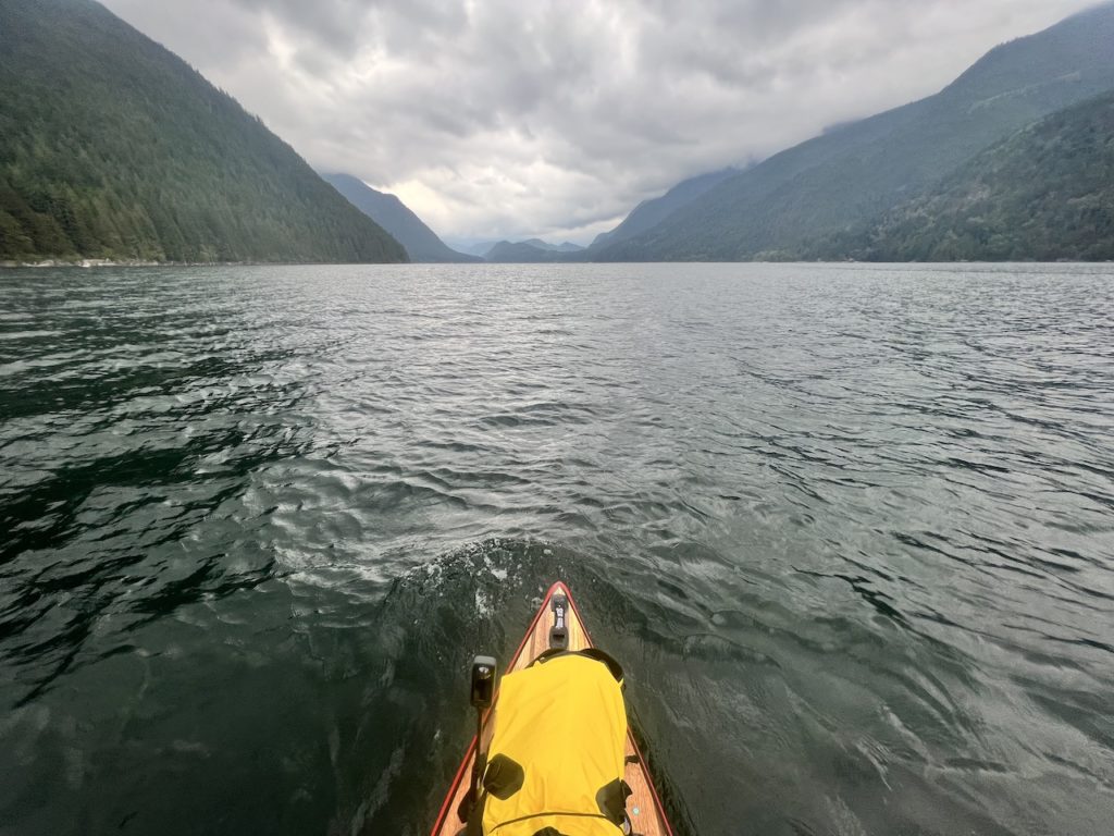
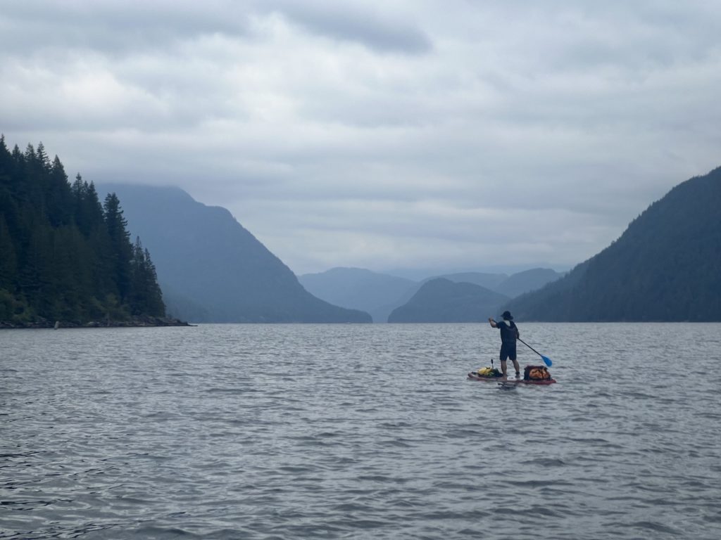
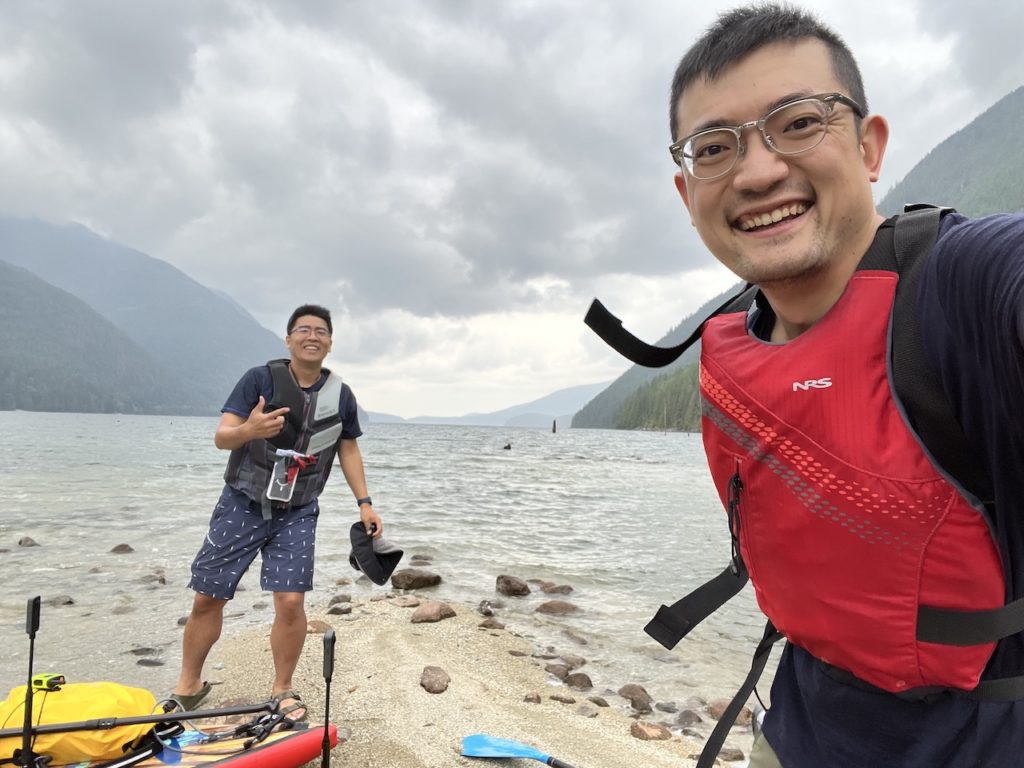
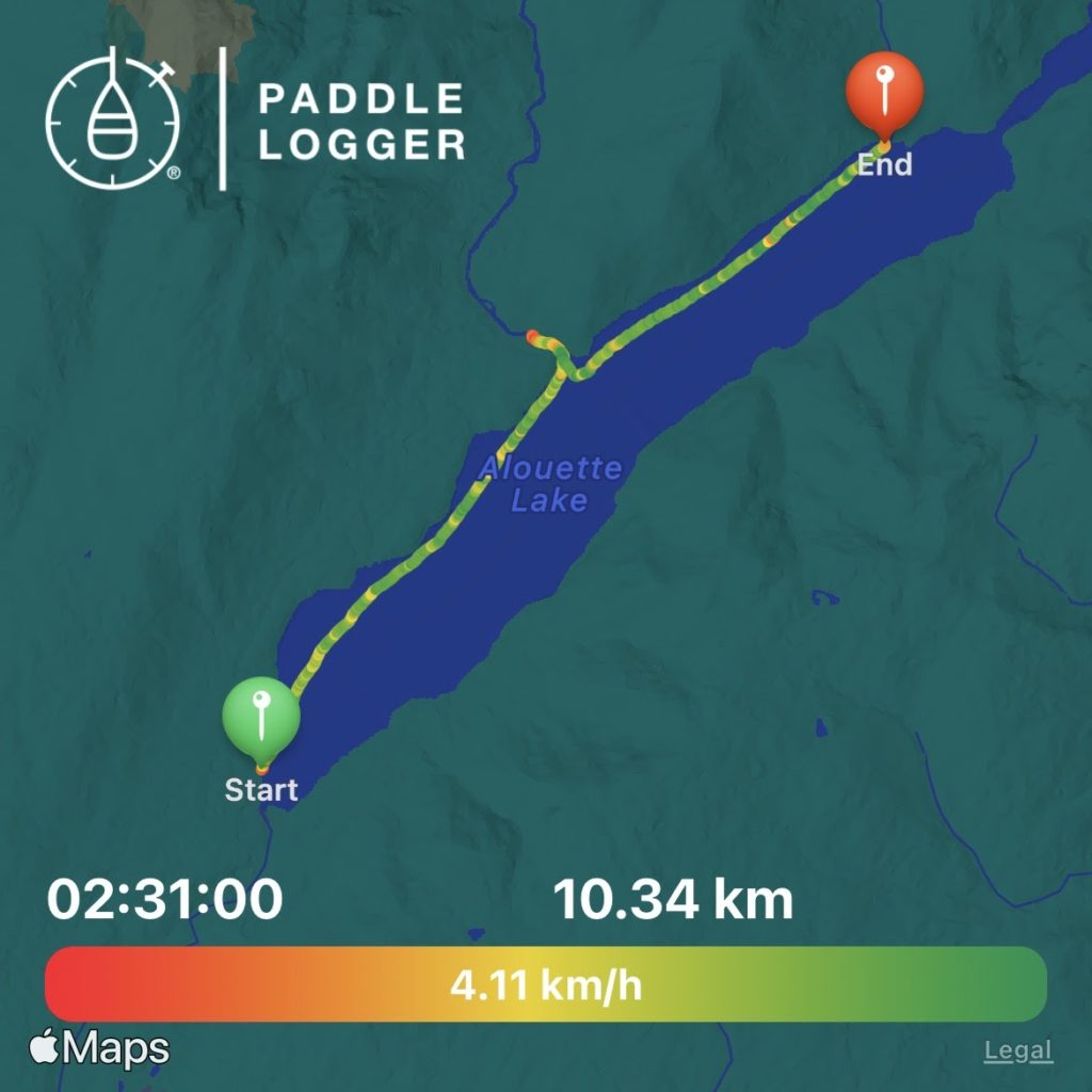
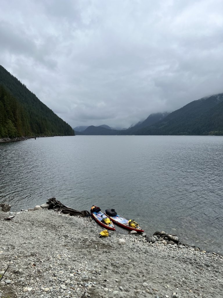
After an easy, wind-assisted 2 hour paddle (plus a 30 min detour at Gold Creek), we reached Moyer Creek campsite just before the rain kicked in.
Video of our outbound journey
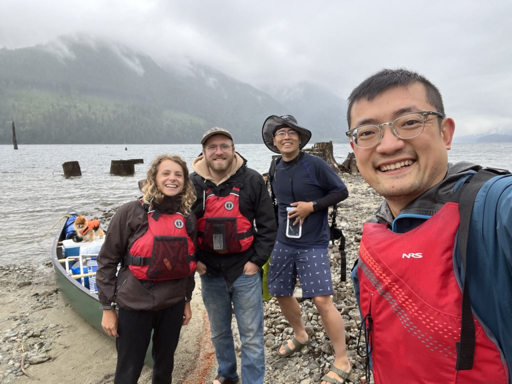
I went to say hi to our neighbors, a friendly couple who canoed here the night before. They explained that the campsites are scattered across the sandy/rocky beach, along Moyer Creek, and that there were more campsites further north around a small cove, but they are mostly occupied by a group of powerboaters.
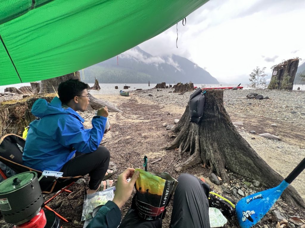
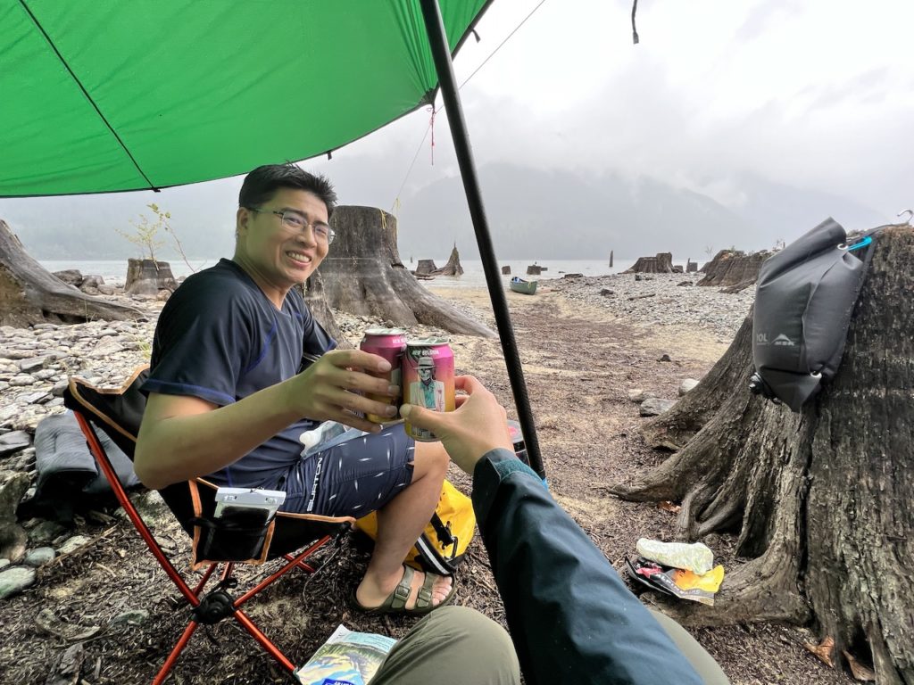
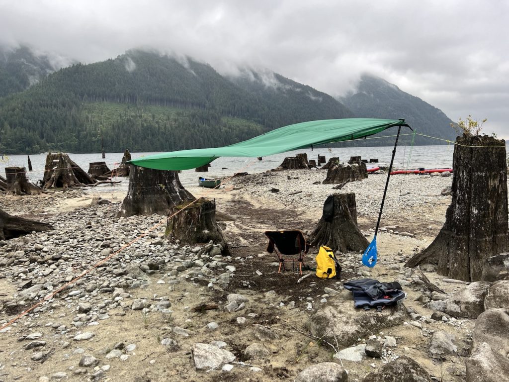
We picked a flat spot on the beach near the neighbors and the rain started to get heavier. We were well prepared with tarps and rain gear, so we weren’t worried. We quickly set up a tarp, then our tent underneath.
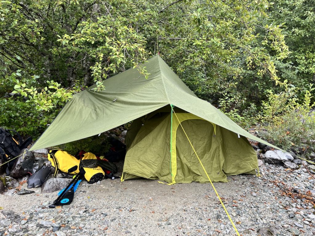

Then we went further out on to the beach and set up a cooking/eating area with another tarp. The backcountry guidelines say we are supposed to cook 100m downwind from our tent for bear safety reasons, but in established wilderness group campsites, I’ve never seen anyone do that. Our camp kitchen was more like 10m away.


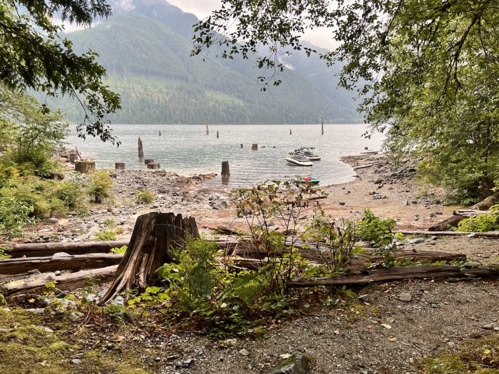
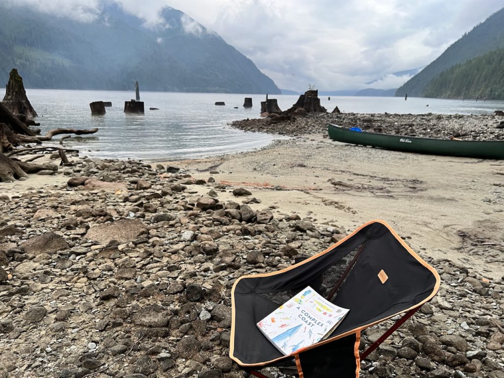
We went to explore the other campsites after a hearty meal. Alouette Lake was dammed and turned into a reservoir in 1926. This is why the lake is shaped like 2 connected sausages; the rise in water level expanded the lake from 2km to 16km in length, flooding the upstream valley. Large tree trunks left from logging are evident along the lake shore, creating some submerged hazards.
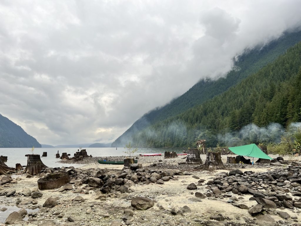
We soon realized that the little beach area we were camping on was flanked by Moyer Creek on both sides. More accurately put, we were camping on the river delta. I wonder if this area is flooded during spring melt when the creek is at its highest. I would also be uncomfortable camping on this beach during periods of heavy rain.
Moyer Creek provides running fresh water, which of course needs to be cooked or filtered before consumption. We were lazy and each packed 10L of water from home.
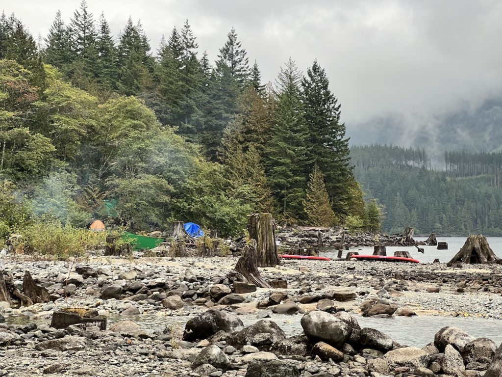
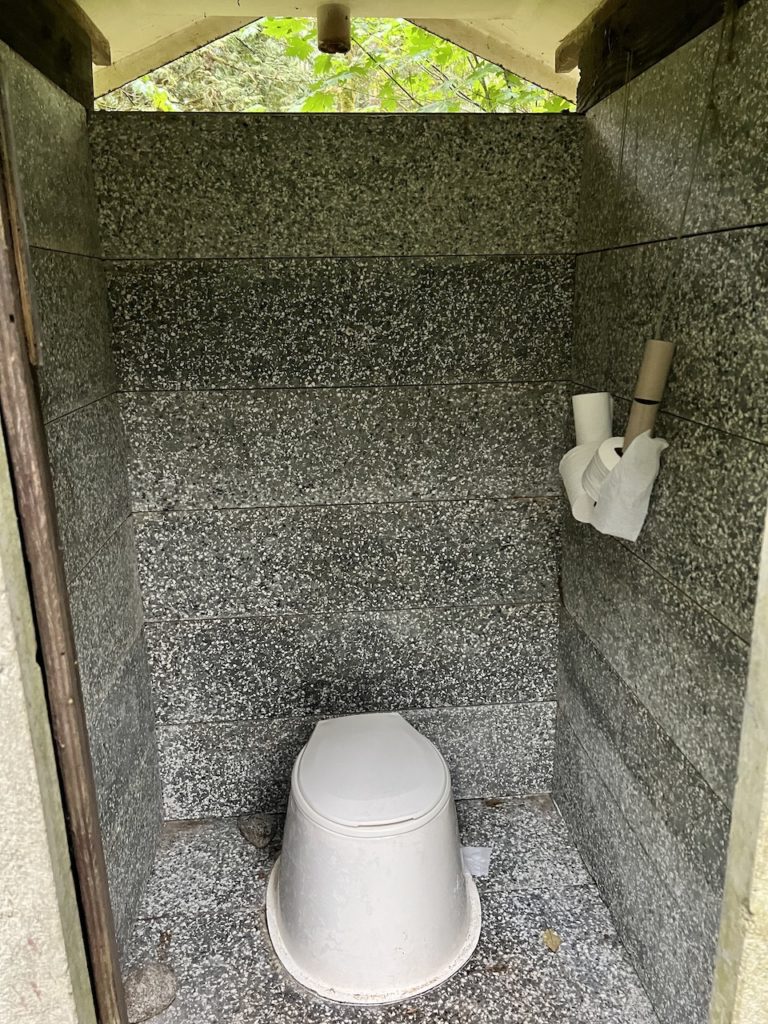
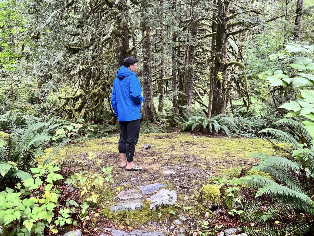
As with other marine campsites we’ve visited, there are sites tucked away in the woods away from the water. A pit toilet is available uphill as well.

Arguably the best camping spot seems to be this large flat area towards the south end of the campsites, with unobstructed views of Alouette Lake. It was occupied by a bright orange tent and tarp, which were as bright as a beacon during most of our paddle north.

We briefly considered jumping back onto our paddleboards for a quick exploration, but the sun was setting soon and relaxing at camp seemed like a better idea. I kicked back and read a few pages of the beautifully illustrated new book “A Complex Coast”, about a guy’s epic kayak journey from Victoria to Alaska. No better setting to read this book, I think.

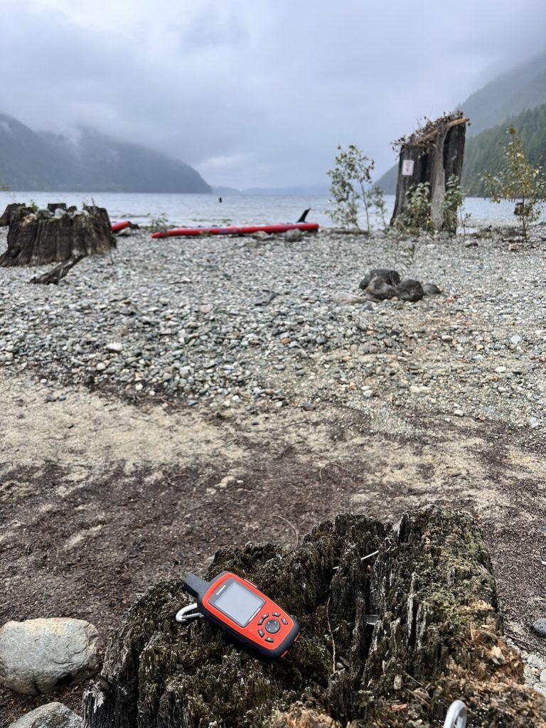
For communication, I activated my Garmin InReach satellite messenger for the trip. This proved helpful as we easily kept in touch with Mission Control (aka. our wives) throughout.
We thought we would call it a night early, but we ended up having a nice long chat with our friendly neighbors late into the night.
In the middle of the night, we were awoken by sounds of strong winds and crashing waves. Worried about our boards on the beach and our camp kitchen near the water, we got up to check on things. Thankfully everything was high and dry, but it was definitely a lot windier than usual.
We woke up and the strong southerly wind continued, and our hopes for a peaceful morning return paddle faded. The forecast called for 6km/h winds, but it felt like at least 15-20km/h. This was a good reminder to hope for the best but plan for the worst when playing in the backcountry. Quickly, we recounted our backup plans:
- Our food and water could last us another 2 days if we couldn’t make it back, and we have 3 water filters between us even if we ran out of water.
- We are 10km away from our car, and we know we can paddle at least 20km.
- North Beach and Campers Beach are merely 5km away, and as long as we can reach it, one of us can walk the rest of the way to drive the car down.
- We have a satellite messenger and can call for help.
- Our wives know exactly where we are and what time to expect us back (I satellite messaged them to push the ETA back twice so they won’t worry).

With all that backup, we were feeling confident to beat the unexpected headwind.
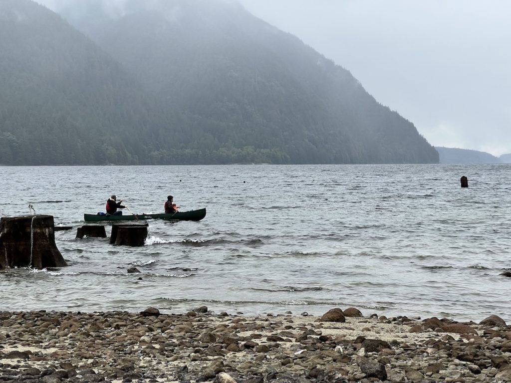
We sent our new friends off first.
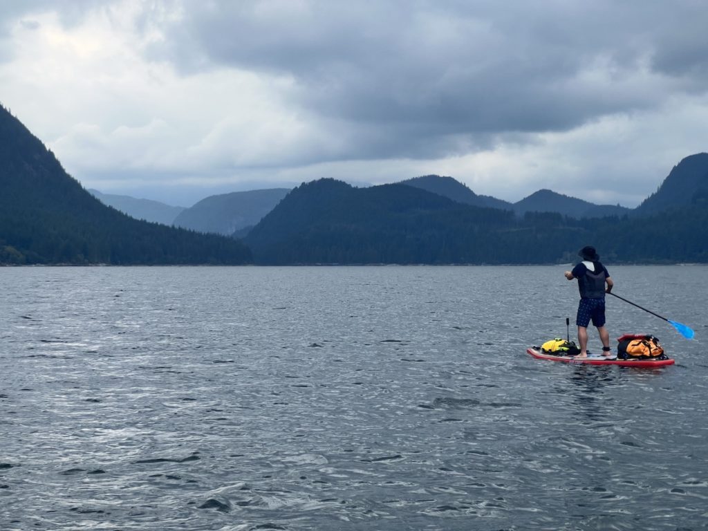
Then we launched into the wind at 11am.

The going was a bit tough but nothing we haven’t done before. A novice would likely struggle though. I was glad we picked Alouette Lake, because Pitt Lake under this wind would be a different beast.
We took breaks at North Beach and Campers Beach, and we still had lots of energy left so we pushed forward. No bail-out needed today!
We arrived at the South Beach at 2:30pm, after a great workout of a paddle for 3.5 hours.
Overall, this paddle was fantastic. I loved the otherworldly feeling of low clouds lingering in the valley and mountain tops. The quick exploration of Gold Creek provided another highlight for the paddle. There were good campsites to choose from right on the beach, as well as some that were more tucked away and private. The sites and pit toilet were all very clean.
Some minor downsides: there were quite a few powerboats and seadoos up and down the lake, and it would have been even busier if the weather was bright and sunny. Since we came on a weekend, the campsites were busier and some nearby campers were playing loud games and playing music (I almost wanted to go over and ask them to at least switch from clubbing music to acoustic guitar), which diminished the serenity.
The two other established marine sites on Alouette Lake are at the Narrows (1km further from Moyer Creek), and Alouette River (7km further north). Interestingly, the eastern shore of Alouette Lake is actually outside the provincial park boundary, and people are known to free camp on these crown lands. I’ve heard horror stories about the state that some people leave these areas in though.
Video of our return journey:
12 responses to “Paddle Camping at Moyer Creek Marine Campsite in Golden Ears Provincial Park”
Thanks very much for the detailed review. I’ve kayak camped at Moyer years ago and it is a special place of paradise for sure. Doing it via SUP is adventurous to say the least but you sound very experienced and prepared. Keep paddling !
Thank you, good sir! SUP camping is actually a lot of fun and quite doable with a touring board (front and back tie down is a must) and some experience.
Well done on the paddle and the report!
Thanks! I am fairly certain that I wouldn’t have been able to do the circumnavigation like you did!
Thanks for another great trip report! Well done 🙂 A friend & I are hoping to sup camp at Alouette Lake this summer, and your detailed notes are really helpful!
Thanks for leaving a comment! Have a fun and safe paddle 🙂
kids and i will be dropping in sat morning and copy your route! MAHALO!
Aloha!
Enjoy, and you’re welcome! 🙂
Wow damn! Amazing trip report and distance covered on paddle boards. Stumbled across your post while searching paddling camping sites.
I’d love to join you guys in the future.
And if you’re up for it, I’d suggest trying for Pitt River Hot Springs next (I’ve been planning for it for ages).
I’m a packrafter myself and am just getting my paddles wet again after a 2-year hiatus with my second child.
Welcome to our blog! Feel free to browse around 🙂 I’m active on some local SUP and kayaking facebook groups, you can find many like-minded enthusiasts there as well.
Pitt River Hot Springs has been on my radar! I have to decide on a canoe + bike vs paddleboard + hike combo though.
I had to look up packrafting, and it looks very intriguing. I’m not sure if it’s suited for a long paddle like this one though, if tracking is an issue.
Hey,
Awesome awesome post, thank you so much!
I’m planning to go there on Saturday, I have my permit already. Are there any parking restrictions regarding what time you have to leave?
Is there a map of all available campsites? I mean these:
-East Beach
-Moyer Creek
-The Narrows
-Alouette River (north end of the lake)
Hello! I believe parking is good for the dates on which you have a backcountry camping permit including the entire day of departure. I looked up the exact location of these marine campsites and updated my blogpost. They are clearly marked on Gaia GPS maps, which is great for adventures 🙂