Thwaytes Landing is a water-access-only, 130-acre property midway up Indian Arm, directly across from the famous Buntzen Powerhouses. The Land Conservancy (TLC), who purchased and transferred the property to GVRD to turn it into a regional park, has a fantastic write-up on its history and features.
In summary, the lot was named after Captain Tom Thwaytes who built a heritage house here with his wife. It changed hands a few times until TLC purchased and donated it to create a regional park to protect the natural features and historical structures against development pressures. Paddlers should be very thankful, since this is one of the only public beaches in Indian Arm between long stretches of steep cliffs. Most other beaches in the Arm are privately owned.
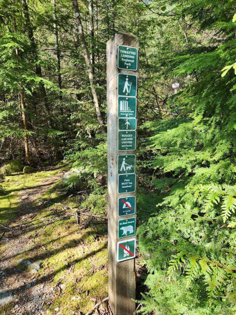
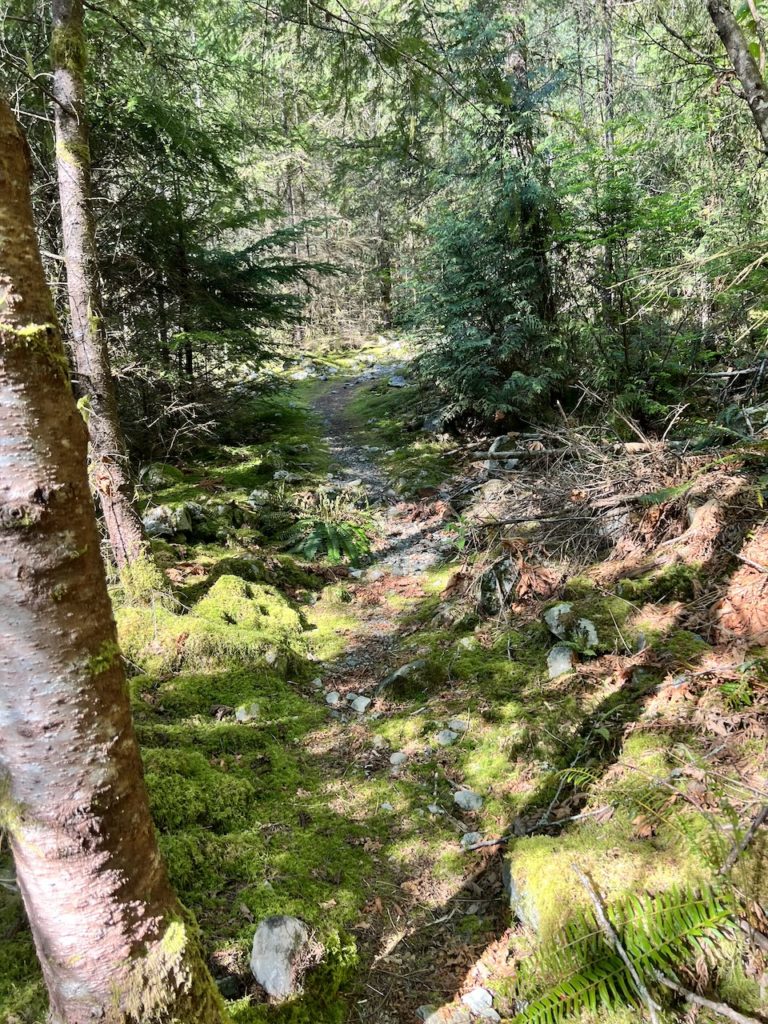
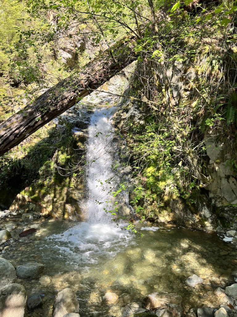
Currently there’s not much going on at Thwaytes Landing. There are no toilets, no garbage receptacles, and no water taps. It is essentially just a place for a landing and rest before continuing onward or turning back. There is a short rugged trail that leads to Holmden Creek Falls, with fresh water supply (but water filtration or treatment is required before consumption).
I regret not paying more attention to where this park was when I paddled past it on my way to Granite Falls a few years ago. I couldn’t count that as a visit to this park since I didn’t even know it existed, so I have to revisit it in order to complete my quest to visit all 23 regional parks in Metro Vancouver regardless of how unexciting this park seems on paper.
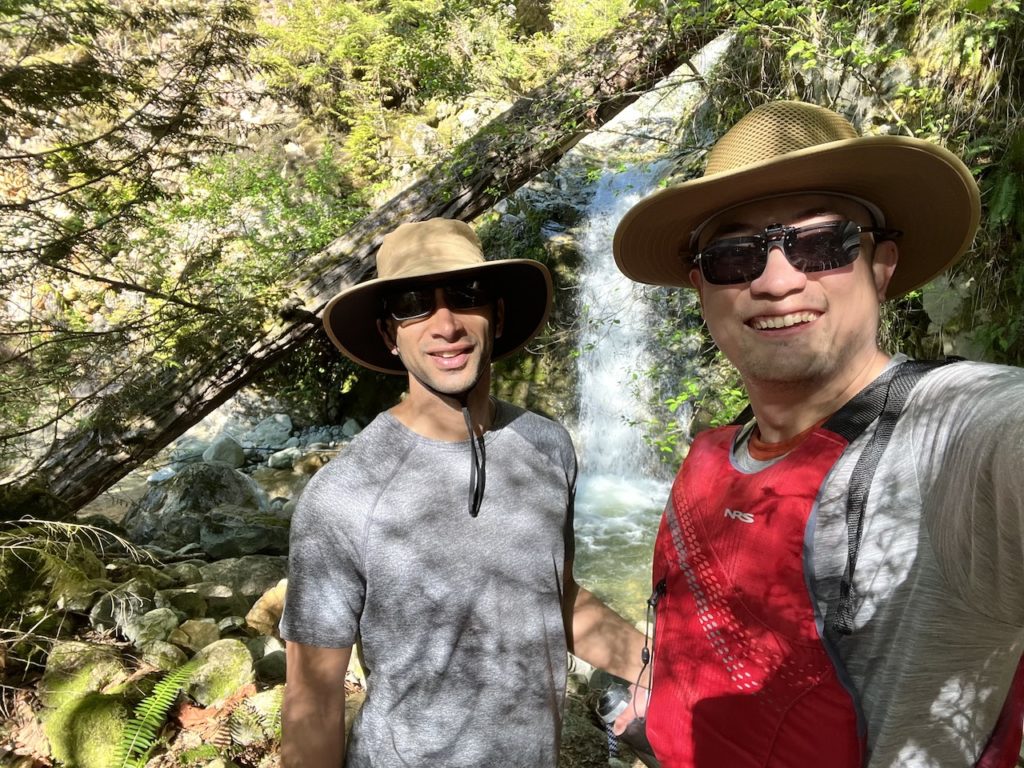
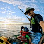
Thankfully, the stars aligned for me to meet up with Mon Jef of I SUP Explore and check this park off my list. A 5-hour paddle in Indian Arm would be near the upper limit of my comfort zone as a solo trip, so I am grateful to have a friend. I’ve been following Mon Jef’s blog ever since I came across it researching for my paddles. His thoughtful commentary and focus on local destinations are very interesting to me as a fellow paddler.
Borrowing from Mon Jef’s detailed and safety-enhancing paddle float plan template:
DATE: Saturday, May 13, 2023
ROUTES: Lowry Waterfront Park to Thwaytes Landing
VESSEL: Red Seagods Carta Marina iSUP
EST. DEP. From home: 0550
EST. ARR. @ Lowry Waterfront Park: 0630
EST. DEP. From Lowry Waterfront Park: 0700
EST. ARR. @ Thwaytes Landing: 0900
EST. DEP. From Thwaytes Landing: 0930
EST. ARR. @ Lowry: 1300
EST. ARR. @ Home: 1400
Paddlers: Mon Jef, Billy
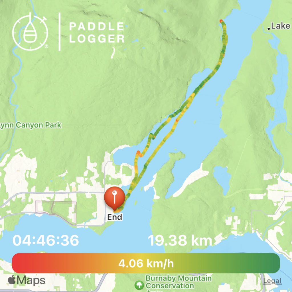
Estimated Out-and-back Distance: 19km
Wind: expected calm morning, and thermal southerly wind as the day warms by mid day. Regional forecast unlikely to prevail over the dominating thermal winds.
For what it’s worth, the red Windy app calls for 3-5km/h southerly winds with gusts of 17-20km/h, the blue Windy.app app calls for 1-8km/h south-westerly winds with minimal gusts, during the planned paddle duration. My experience tells me to plan for the most pessimistic of forecasts.
Air Temperature: 17-28 degrees C
Water Temperature: 15 degrees C
Daylight: 5:31 am – 8:46 pm
Civil Twilight: 4:53 am – 5:31 am; 8:46 pm – 9:24 pm
Nautical Twilight: 4:03 am – 4:53 am; 9:24 pm – 10:15 pm
Tides:
High 1:59am 4.4 m
Low: 8:21am 3 m
High: 12:22pm 3.4 m
Low: 7:22pm 1.6 m
Basically paddling during slack tide between the little low and little high tide of the day.
Paddle Report
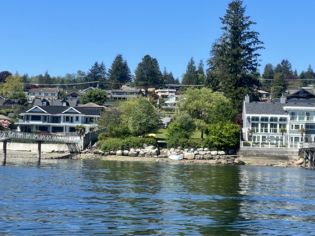
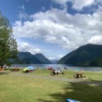
Lowry Waterfront Park is a vacant city lot sandwiched between private houses. Its main purpose seems to be providing public beach access, since it’s much too small for anything else. There are only 4 parking spots at the park, but there is ample street parking around.
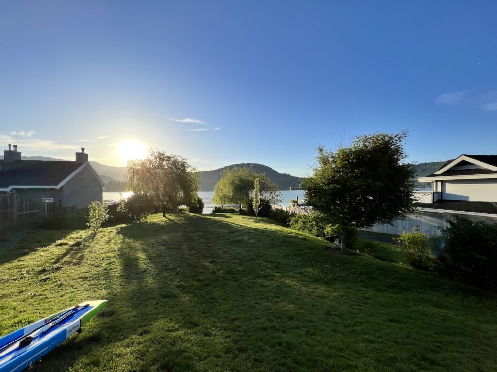
It’s a good alternative to launching from Deep Cove, about 2.5km or 30 mins paddling to the north, if one wants to avoid the congestion. There were some fairly large rocks to navigate over before reaching the rocky beach.
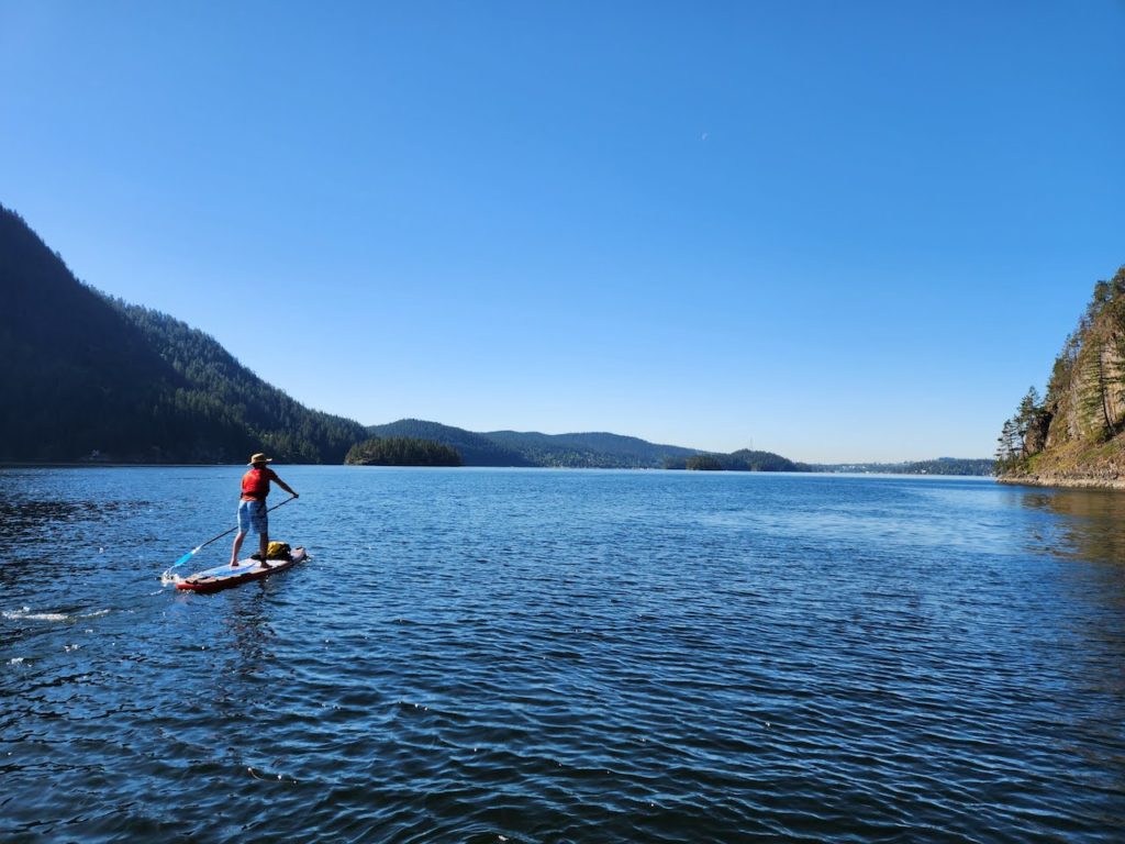
We started right on time, and the water was quite still for most of our outbound paddle. There were a few boats and paddlers on the water, but otherwise it was a very calm morning. We chatted about blogging, raising children, and of course paddling.
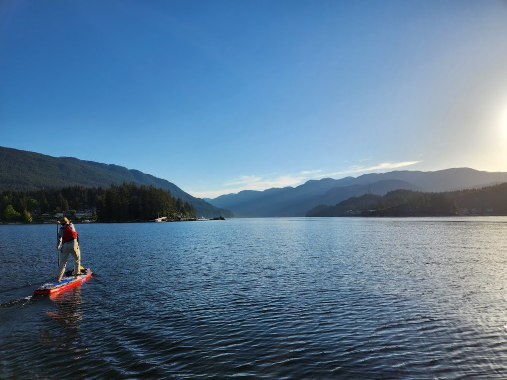
The morning light and shadow was playing tricks on us. We had some fun trying to locate Twin Island, which blended perfectly into the background except for a small lighthouse at its end. Paddling from Lowry to Twin Island would probably take 1.5 hours.
For almost the entire paddle, the Buntzen Powerhouse was in view. It looked deceptively close, and it’s a good marker of our destination. But seeing where the finish line is this early on took some of the sense of exploration away.
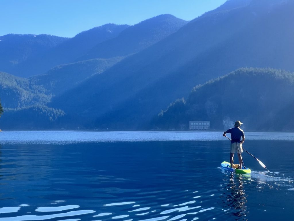
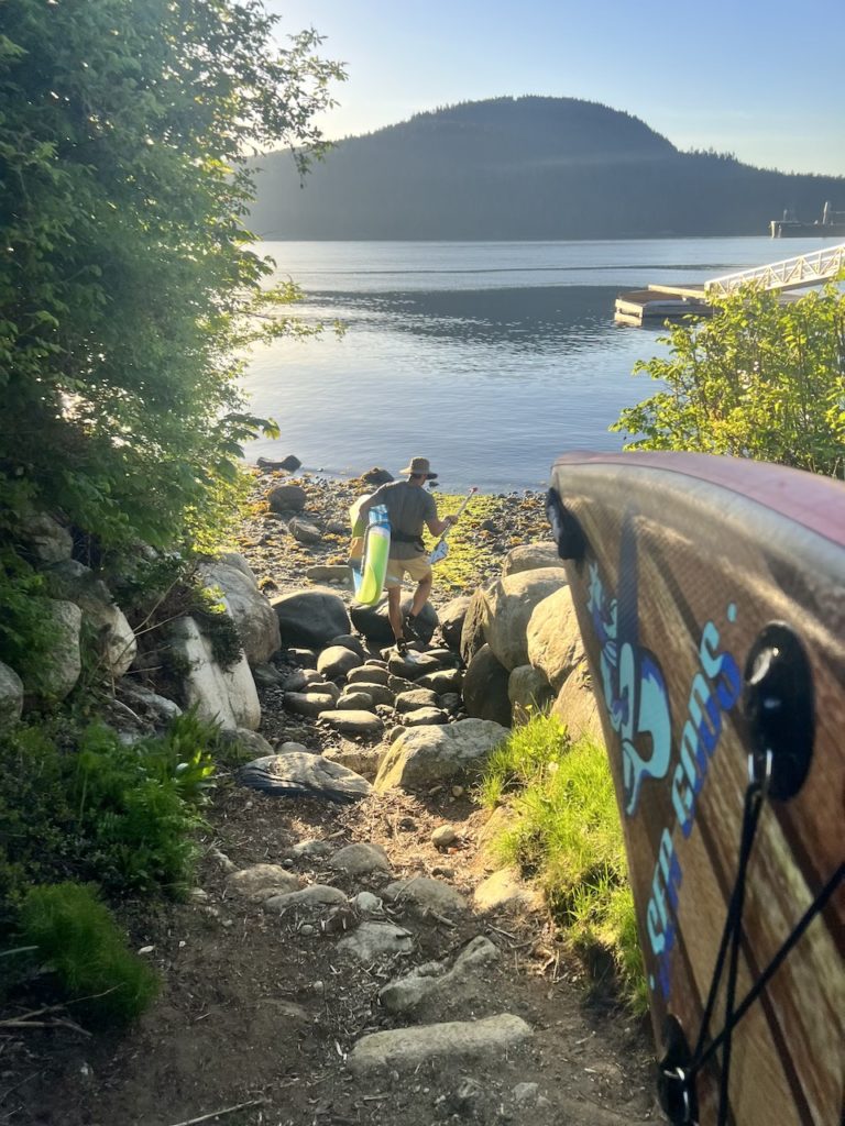
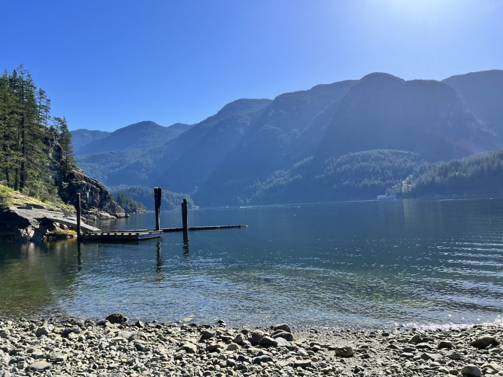
We paddled past Camp Jubilee and arrived at a group of private homes with docks. Thwaytes Landing lied just beyond the private docks, marked with a Regional Park sign. Unfortunately, the dock on which the sign stood was also private, so we have to land on the small rocky beach next to it.
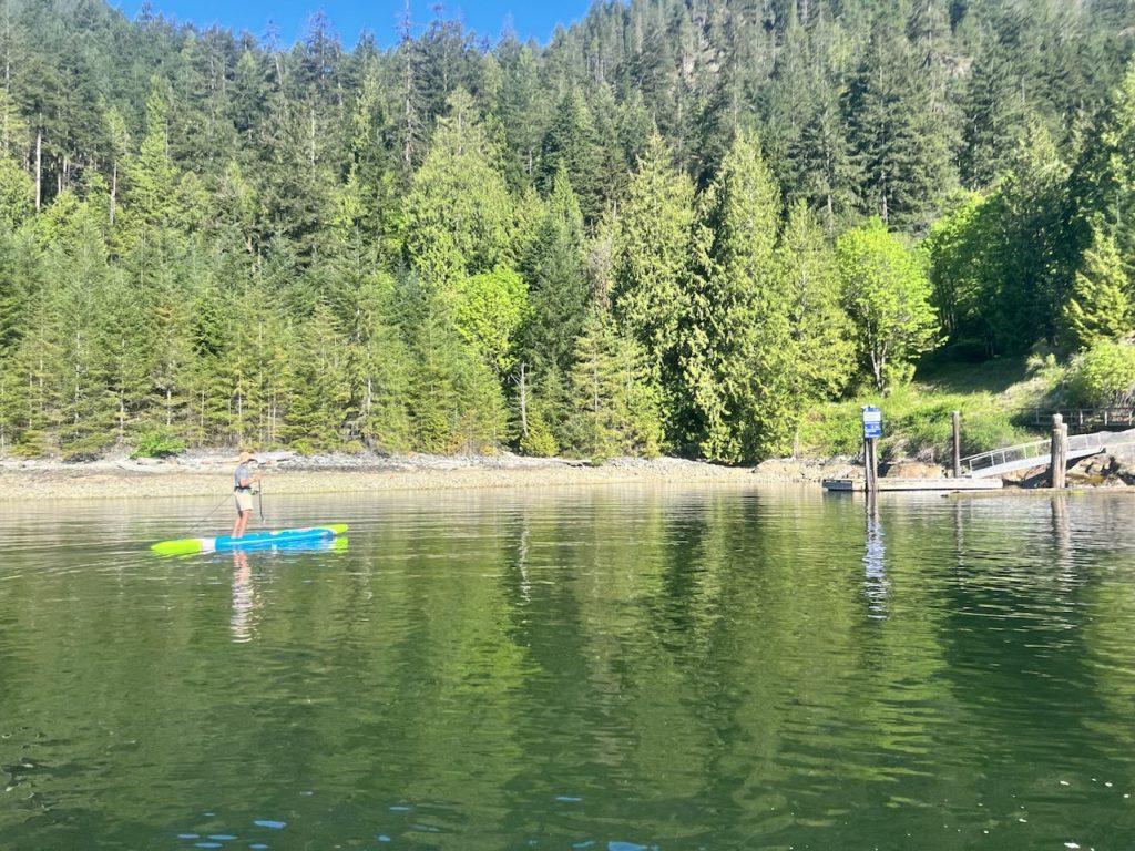
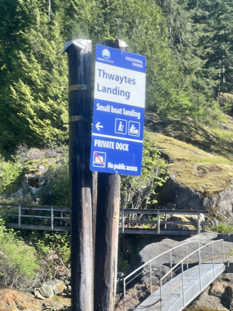
We wondered why the dock wasn’t included in the regional park, since it’s not connected to any private residence. There seems to be a trail that leads away from the dock, presumably to the heritage building, but the trail was closed.
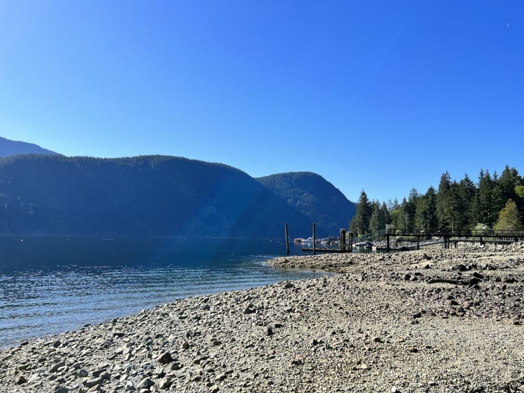
We had some snacks and went exploring a little bit. This is by far the smallest Metro Vancouver Regional Park, and looks to be essentially neglected.
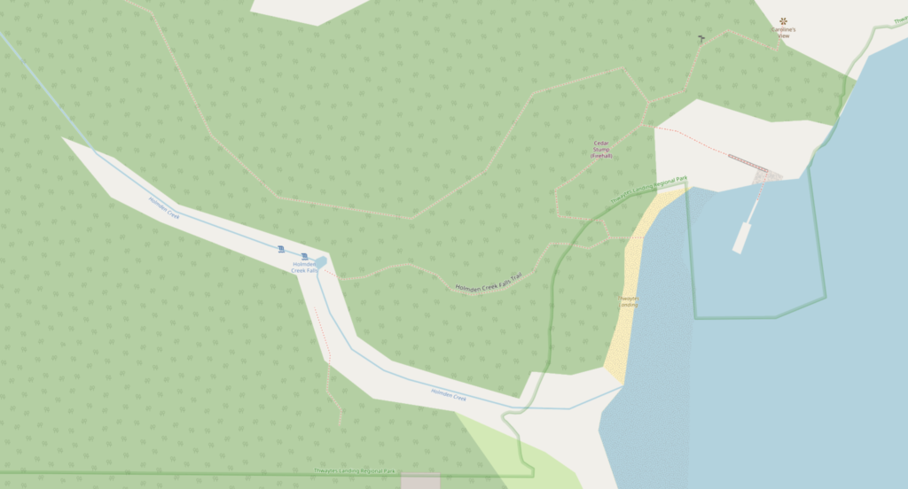
A 120m trail leads from the beach to Holmden Creek Falls. The trail is mapped on OpenStreetMap: https://www.openstreetmap.org/#map=19/49.37672/-122.89032
We checked out the waterfall, which would do nicely if one needs some fresh water. For day trips like this, I learned that it’s easier to just pack some extra water.
We didn’t want to linger too much because we were concerned about the thermal winds picking up soon. Someone did a more thorough job with exploring Thwaytes Landing and wrote about it here: https://forums.clubtread.com/27-british-columbia/94938-thwaytes-landing.html. From the photos he posted, we didn’t miss much.

The paddle back was surprisingly calm as well. The dreaded thermal winds didn’t really pick up at all, so we made great time. There were many more paddlers and boaters on our return trip. Mon Jef tried to surf the boat wakes, some of which were quite substantial.
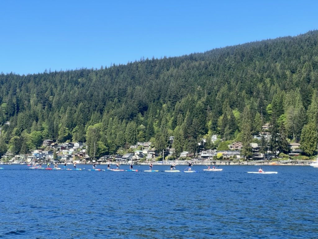
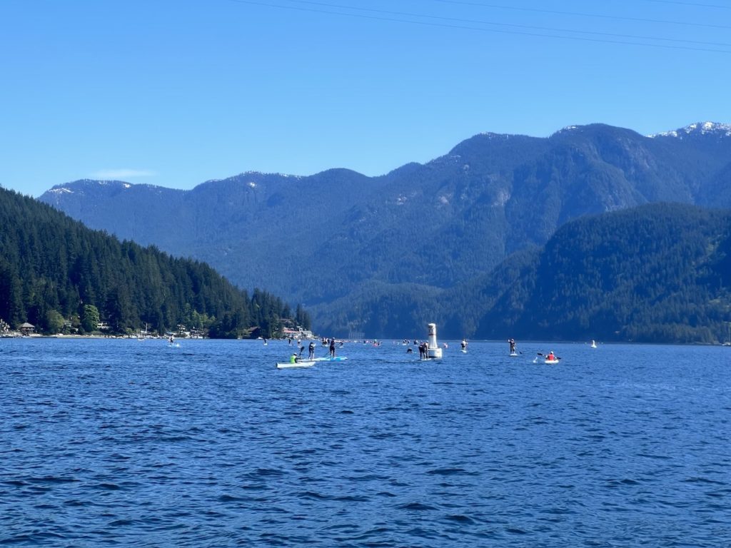
When we got to Deep Cove around 11am, the Board the Fjord race was on, so we stopped to watch. Mon Jef recognized some of the pro level paddleboarders which I thought was very cool.
With the very cooperative wind conditions, we arrived back at Lowry before 12, an hour earlier than I expected.
It was a great morning meeting paddling with Mon Jef, and I am very happy to check off this difficult-to-get-to regional park.
A paddle in Indian Arm is always enjoyable, but Thwaytes Landing itself is basically a paddler’s rest stop. It is so different from all the other regional parks, I think it would be more fitting to be included in Say Nuth Khaw Yum Provincial Park as a day use area.
Follow us as we explore all 23 Regional Parks in Metro Vancouver!
Discover more from Outdoor Family
Subscribe to get the latest posts sent to your email.
Nice work on the write-up as always! What a spectacular morning it was for early May. It felt like mid-summer for the heat! Hot weather and minimal wind. Perfect for paddling.
It’s a great paddle and even a greater pleasure to meet you! Let’s do it again soon 🙂
Pingback: Best Places for Paddleboarding Beginners in Vancouver -